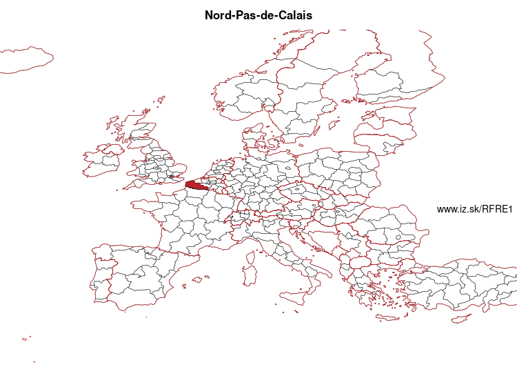
Nord-Pas-de-Calais – FRE1
EU regions: France > Hauts-de-France > Nord-Pas-de-Calais
| Indicator | Period | Value |
|---|---|---|
| Life long learning | ||
| life long learning participation | 2023 | 13 |
| Part time jobs and flexible employment | ||
| percentage of part time workers | 2022 | 17.18 |
| percentage of part time workers, men | 2022 | 5.99 |
| percentage of part time workers, women | 2022 | 29.07 |
| Gender differences | ||
| gender gap in employment rate | 2023 | 91.24 |
| gender gap in unemployment rate | 2023 | 102.06 |
| Graduates and young people | ||
| unemployment rate of youth with elementary education | 2023 | 50.9 |
| NEET | 2023 | 14.5 |
| Gross domestic product | ||
| GDP per capita in PPS of EU average | 2022 | 82 |
| Employment | ||
| employment rate | 2023 | 63.2 |
More on wikipedia wikidata Q16987 on OpenStreetMap Nord-Pas-de-Calais slovensky: FRE1
Subregions: Nord, Pas-de-Calais
Unemployment
| Indicator | Period | Value |
|---|---|---|
| Unemployment | ||
| unemployment rate | 2023 | 9.9 |
| youth unemployment rate | 2023 | 23.2 |
| Long term unemployment | ||
| long term unemployment | 2023 | 2.8 |
| share of long term unemployed | 2023 | 29 |
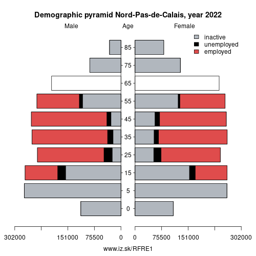
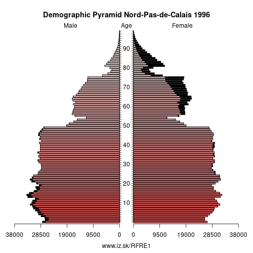
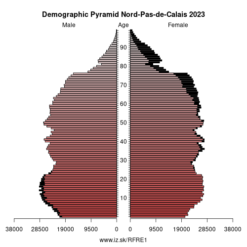
Demographics
| Indicator | Period | Value |
|---|---|---|
| Demographics | ||
| number of inhabitants | 2023 | 4.070111e+06 |
| population density | 2021 | 327.9 |
| old-age dependency ratio | 2023 | 30.7 |
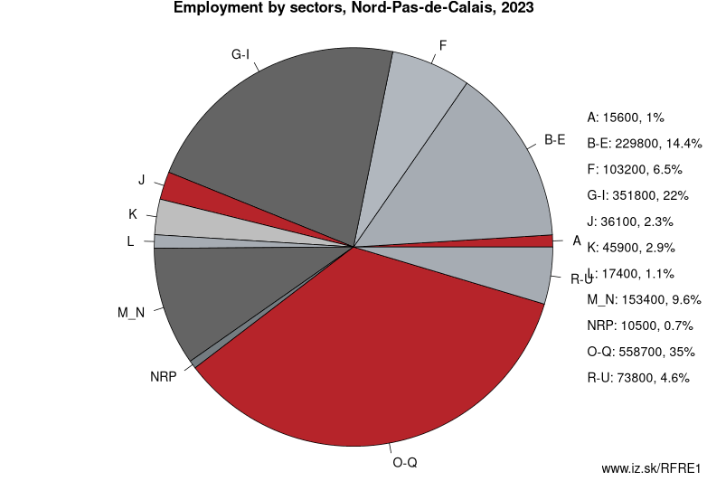
Employment by sectors, Nord-Pas-de-Calais
| NACE r2 | % | NACE r2 | % | ||
|---|---|---|---|---|---|
| A | 15.6 | 1 % | B-E | 229.8 | 14 % |
| F | 103.2 | 6 % | G-I | 351.8 | 22 % |
| J | 36.1 | 2 % | K | 45.9 | 3 % |
| L | 17.4 | 1 % | M_N | 153.4 | 10 % |
| NRP | 10.5 | 1 % | O-Q | 558.7 | 35 % |
| R-U | 73.8 | 5 % | TOTAL | 1596.1 | 100 % |
Data for the period year 2023. Source of the data is Eurostat, table [lfst_r_lfe2en2].
Nord-Pas-de-Calais (French pronunciation: [nɔʁ.pɑ.d(ə).ka.lɛ] (listen)) is a former administrative region of France. Since 1 January 2016, it has been part of the new region Hauts-de-France. It consisted of the departments of Nord and Pas-de-Calais. Nord-Pas-de-Calais borders the English Channel (west), the North Sea (northwest), Belgium (north and east) and Picardy (south). The majority of the region was once part of the historical (Southern) Netherlands, but gradually became part of France between 1477 and 1678, particularly during the reign of king Louis XIV. The historical French provinces that preceded Nord-Pas-de-Calais are Artois, French Flanders, French Hainaut and (partially) Picardy. These provincial designations are still frequently used by the inhabitants.
With its 330.8 people per km2 on just over 12,414 km2, it is a densely populated region, having some 4.1 million inhabitants, 7 % of France's total population, making it the fourth most populous region in the country, 83 % of whom live in urban communities. Its administrative centre and largest city is Lille. The second largest city is Calais, which serves as a major continental economic/transportation hub with Dover of Great Britain 42 kilometres (26 mi) away; this makes Nord-Pas-de-Calais the closest continental European connection to the island of Great Britain. Other major towns include Valenciennes, Lens, Douai, Béthune, Dunkirk, Maubeuge, Boulogne, Arras, Cambrai and Saint-Omer.
Other: Hauts-de-France, Picardy, Nord-Pas-de-Calais
Neighbours: Hainaut, Picardy, West Flanders
Subregions: Nord, Pas-de-Calais
Suggested citation: Michal Páleník: Europe and its regions in numbers - Nord-Pas-de-Calais – FRE1, IZ Bratislava, retrieved from: https://www.iz.sk/PFRE1, ISBN: 978-80-970204-9-1, DOI:10.5281/zenodo.10200164
 Share
Share Facebook
 Twitter
 News
News