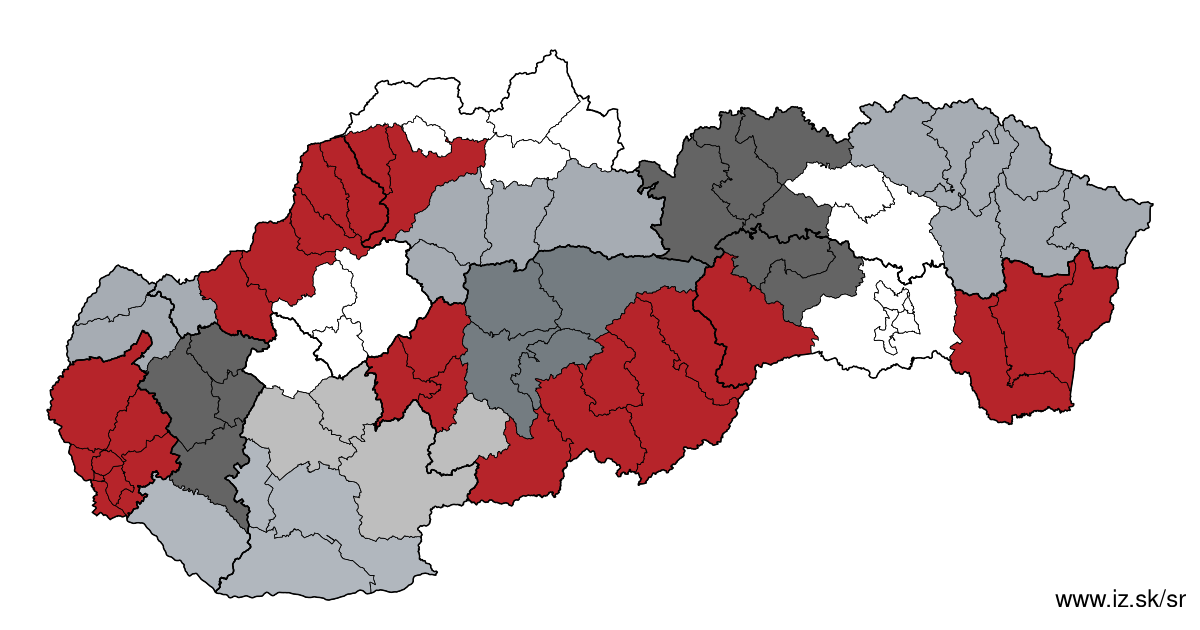
Region Juhoslovenská kotlina
consists of counties:
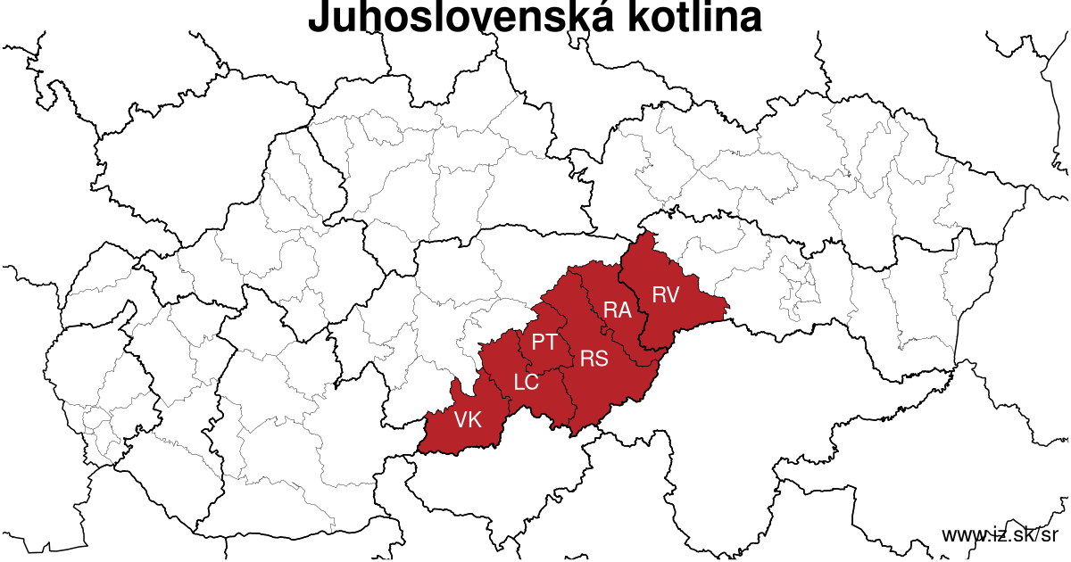
Towns
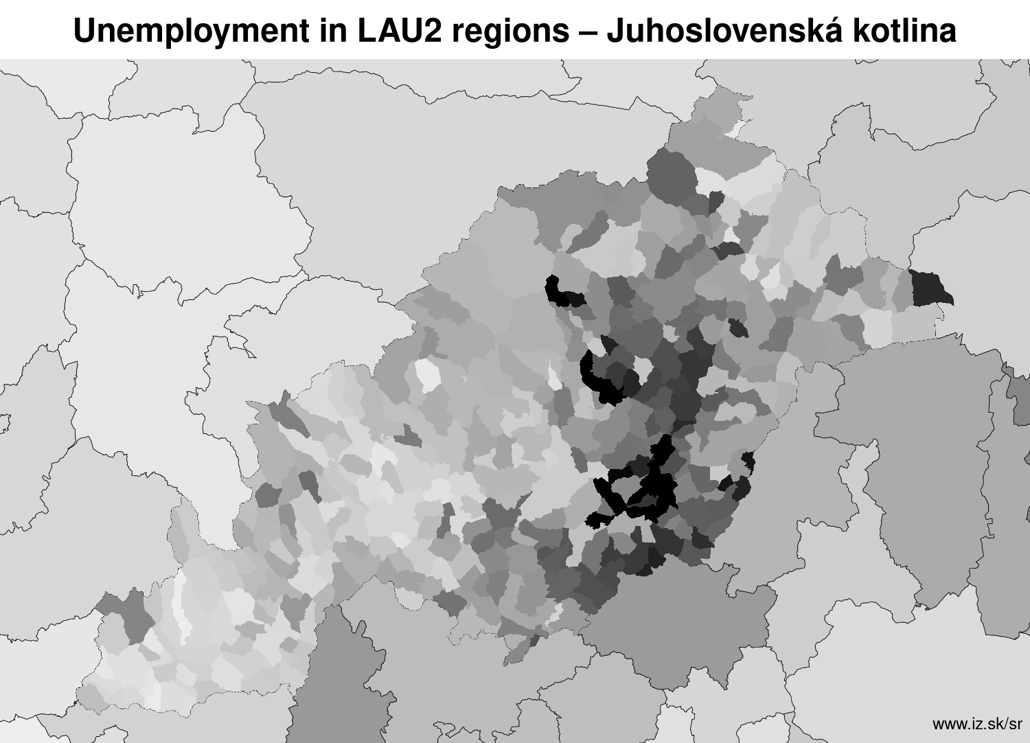
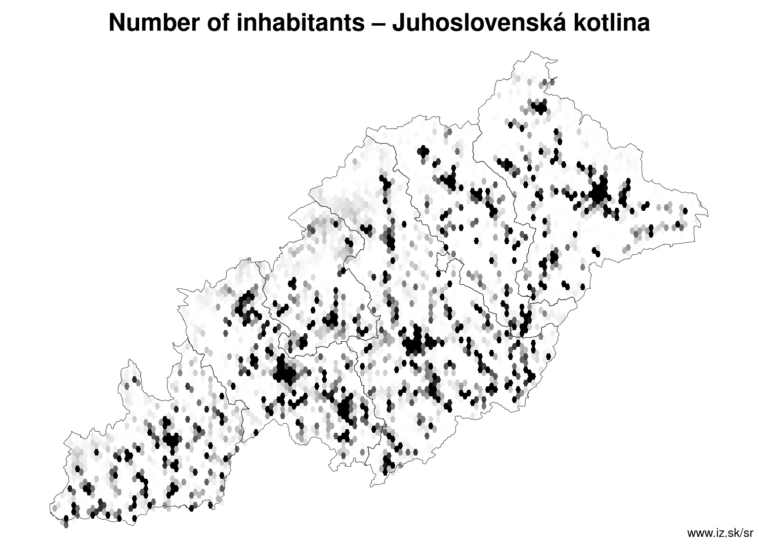
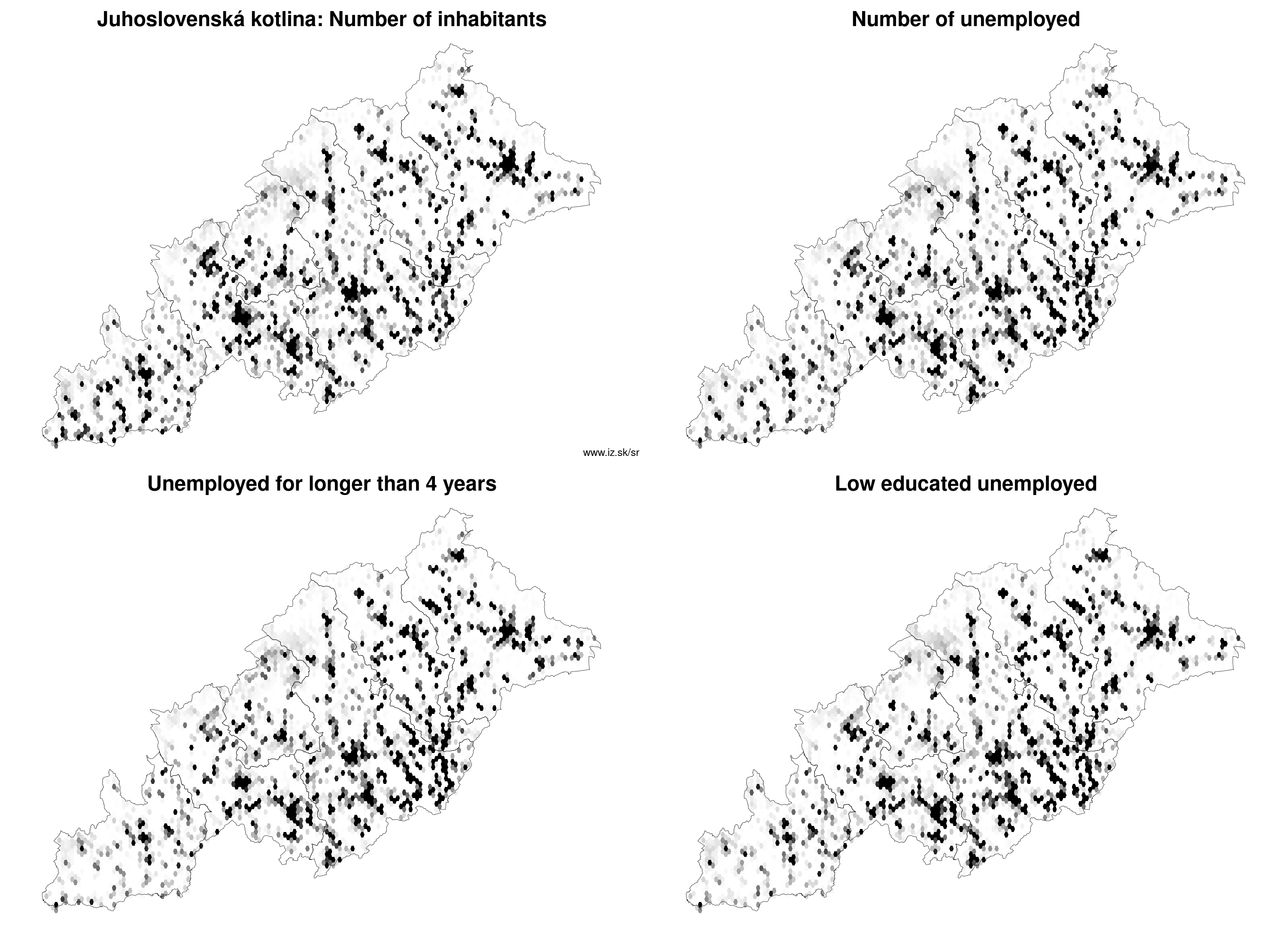
Region Juhoslovenská kotlina contains cities Dobšiná, Fiľakovo, Hnúšťa, Jelšava, Lučenec, Modrý Kameň, Poltár, Revúca, Rimavská Sobota, Rožňava, Tisovec, Tornaľa, Veľký Krtíš and 348 villages. More on oma.sk. Statistics on city level on unemployment are for the period of 2024-02-01, for population are fore yar 2021.
name | number of inhabitants in economically active age | number of unemployed number of unemployed women number of long-term unemployed | unemployment rate unemployment rate of women long-term unemployment rate |
|---|---|---|---|
 Lučenec | 25 614 17 074 | 931 469 437 | 5.5 % 5.3 % 2.6 % |
 Rimavská Sobota | 21 842 14 664 | 1 039 519 520 | 7.1 % 7 % 3.5 % |
 Rožňava | 17 347 11 550 | 821 412 335 | 7.1 % 6.9 % 2.9 % |
 Revúca | 11 273 7 557 | 565 312 283 | 7.5 % 8.3 % 3.7 % |
 Veľký Krtíš | 10 866 7 491 | 292 146 93 | 3.9 % 3.9 % 1.2 % |
 Fiľakovo | 9 861 6 663 | 572 336 301 | 8.6 % 10 % 4.5 % |
 Tornaľa | 6 887 4 664 | 588 323 362 | 12.6 % 14.1 % 7.8 % |
 Hnúšťa | 6 714 4 541 | 433 208 201 | 9.5 % 9.3 % 4.4 % |
 Poltár | 5 235 3 536 | 309 156 143 | 8.7 % 8.8 % 4 % |
 Dobšiná | 5 129 3 189 | 422 215 217 | 13.2 % 13.9 % 6.8 % |
 Tisovec | 3 693 2 424 | 218 118 97 | 9 % 9.9 % 4 % |
 Jelšava | 3 171 2 151 | 352 202 214 | 16.4 % 19.8 % 9.9 % |
 Modrý Kameň | 1 632 1 101 | 79 32 25 | 7.2 % 6.2 % 2.3 % |
Villages with over 2000 inhabitants are Klenovec (3013), Krásnohorské Podhradie (2810), Kokava nad Rimavicou (2756), Jesenské (2336), Kalinovo (2229), Plešivec (2214), Rimavská Seč (2189), Cinobaňa (2032), Divín (2020).
| villages by number of inhabitants | ||||||
|---|---|---|---|---|---|---|
| total | up to 300 | 300 to 500 | 500 to 1000 | 1000 to 1500 | over 1500 | |
| 348 | 146 | 74 | 86 | 24 | 18 | |
Unemployment
| rok | 2012 | 2014 | 2016 | 2018 | 2019 | 2020 | 2021 | 2022 | 2023 |
|---|---|---|---|---|---|---|---|---|---|
| number of unemployed | 48 321 | 46 176 | 37 850 | 24 710 | 22 260 | 24 957 | 26 095 | 23 311 | 22 532 |
| number of long-term unemployed | 31 156 | 32 161 | 24 344 | 13 471 | 11 644 | 12 100 | 14 714 | 13 638 | 12 695 |
| number of people receiving social benefits | 59 001 | 55 795 | 42 677 | 31 534 | 28 521 | 27 436 | 25 320 | 25 335 | 24 853 |
| number of activational workers | |||||||||
| unemployment rate | 20.6 | 20 | 16.7 | 11.1 | 10.1 | 11.5 | 12.6 | 11.4 | 11 |
| long-term unemployment rate | 13.3 | 13.9 | 10.7 | 6.1 | 5.3 | 5.6 | 7.1 | 6.7 | 6.2 |
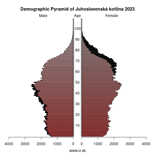
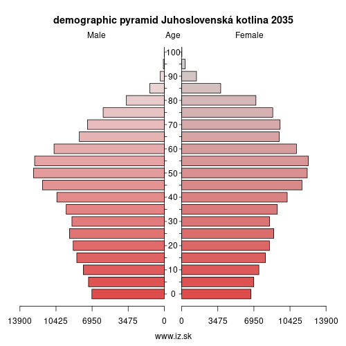
Demographics
| 2012 | 2014 | 2016 | 2018 | 2019 | 2020 | 2021 | 2022 | 2023 | |
|---|---|---|---|---|---|---|---|---|---|
| number of inhabitants | 330 703 | 329 135 | 327 109 | 325 110 | 323 718 | 322 498 | 309 416 | 307 810 | 307 810 |
| assignation tax | 66 919 300 | 71 885 446 | 85 822 304 | 103 386 289 | 116 283 275 | 119 489 335 | 114 296 658 | 126 383 525 | 138 649 060 |
| demographic dependency | 19.7 | 21.0 | 22.7 | 24.8 | 25.8 | 26.8 | 27.2 | 28.2 | 28.8 |
| number of employed foreigners | 117 | 393 | 644 | 964 | 1142 | 1041 | 1546 | 2047 | 2247 |
Number of unemployed
| rok | 2012 | 2014 | 2016 | 2018 | 2019 | 2020 | 2021 | 2022 | 2023 |
|---|---|---|---|---|---|---|---|---|---|
| less than 24 years | 9861 | 7343 | 5057 | 2738 | 2487 | 3043 | 3127 | 2730 | 2716 |
| 25 to 39 years | 20 819 | 17 136 | 13 695 | 8251 | 7352 | 8295 | 8483 | 7605 | 7237 |
| 40 to 54 years | 18 734 | 15 999 | 13 665 | 9117 | 8188 | 8984 | 9417 | 8454 | 8257 |
| 55 years and more | 5881 | 5698 | 5433 | 4603 | 4234 | 4636 | 5068 | 4522 | 4321 |
Other regions
- Basic data on Slovak regions
- Labour market indicators of slovak regions.
- Region Bratislava and surroundings
- Region Kopanice
- Region Danube river
- Region lower Vah river
- Region middle Vár river
- Region upper Nitra river
- Region lower Nitra river
- Region Mining cities
- Region Kysuce a Orava
- Region upper Vah river – Liptov
- Region Spiš cities
- Region upper Hron river
- Region Juhoslovenská kotlina
- Region Košice fold and Torysa river
- Region upper Zemplín
- Region lower Zemplín
Suggested citation: Michal Páleník: Regions of Slovakia - Region Juhoslovenská kotlina, IZ Bratislava, retrieved from: https://www.iz.sk/en/projects/regions-of-slovakia/juhoslovenska-kotlina
Regions of the Slovak Republic
Due to the need of analysis we have created regions of Slovakia. We will bring more information about these regions from the macroeconomic point of view as well as from the point of view of the labour market.. . .
 Share
Share Facebook
 Twitter
 News
News