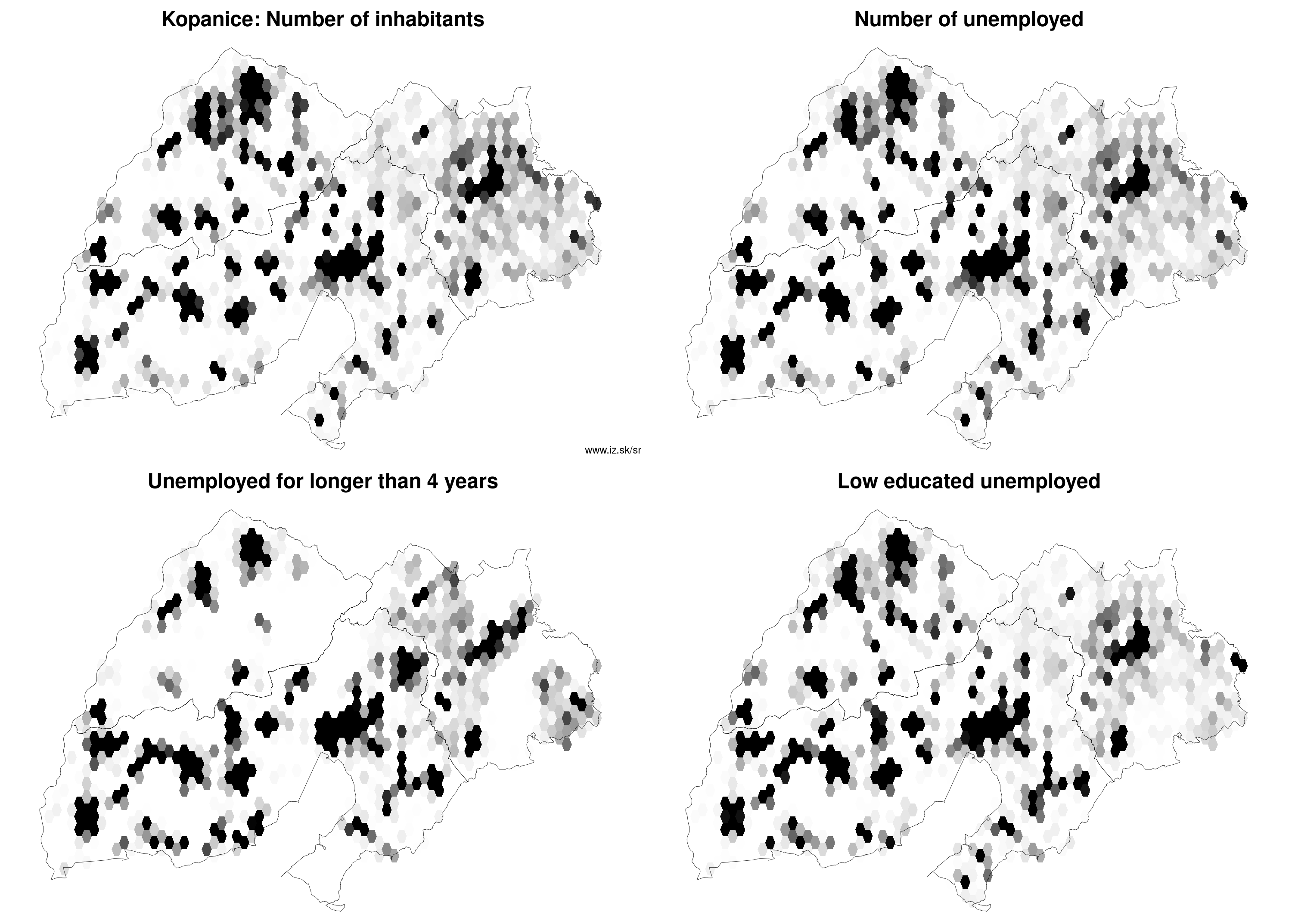
Region Kopanice
consists of counties:
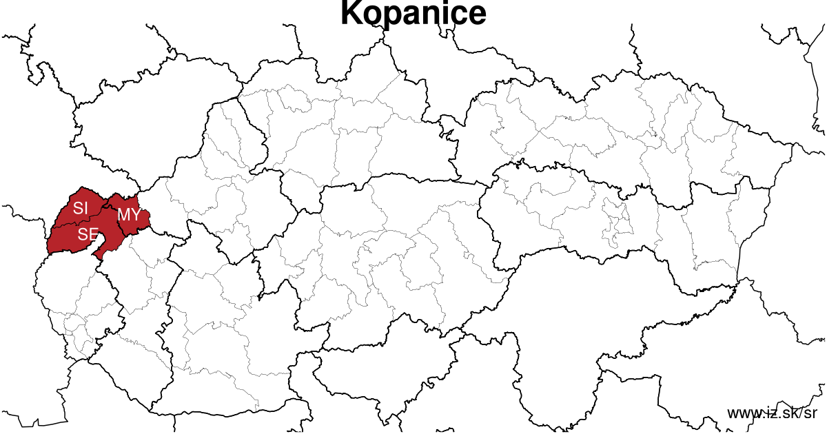
Towns
Region Kopanice contains cities Brezová pod Bradlom, Gbely, Holíč, Myjava, Šaštín-Stráže, Senica, Skalica and 62 villages. More on oma.sk. Statistics on city level on unemployment are for the period of 2026-06-01, for population are fore yar 2025.
name | number of inhabitants in economically active age | number of unemployed number of unemployed women number of long-term unemployed | unemployment rate unemployment rate of women long-term unemployment rate |
|---|---|---|---|
 Senica | 18 970 12 426 | 535 282 135 | 4.3 % 4.6 % 1.1 % |
 Skalica | 15 358 9 953 | 324 174 59 | 3.3 % 3.5 % 0.6 % |
 Holíč | 10 735 7 127 | 261 133 46 | 3.7 % 3.9 % 0.6 % |
 Myjava | 10 316 6 458 | 195 92 31 | 3 % 2.9 % 0.5 % |
 Šaštín-Stráže | 4 848 3 254 | 220 122 78 | 6.8 % 7.8 % 2.4 % |
 Gbely | 4 801 3 144 | 118 67 29 | 3.8 % 4.5 % 0.9 % |
 Brezová pod Bradlom | 4 496 2 897 | 97 45 16 | 3.3 % 3.2 % 0.6 % |
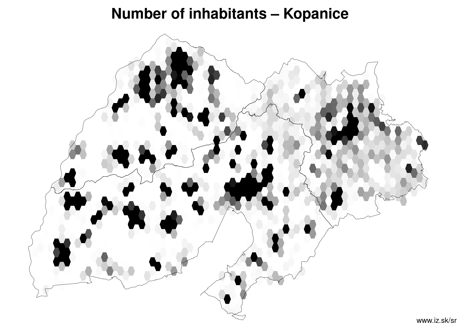
Villages with over 2000 inhabitants are Kúty (4008), Borský Mikuláš (4002), Kopčany (2553), Brodské (2248), Jablonica (2222), Moravský Svätý Ján (2126).
| villages by number of inhabitants | ||||||
|---|---|---|---|---|---|---|
| total | up to 300 | 300 to 500 | 500 to 1000 | 1000 to 1500 | over 1500 | |
| 62 | 4 | 14 | 23 | 11 | 10 | |
Unemployment
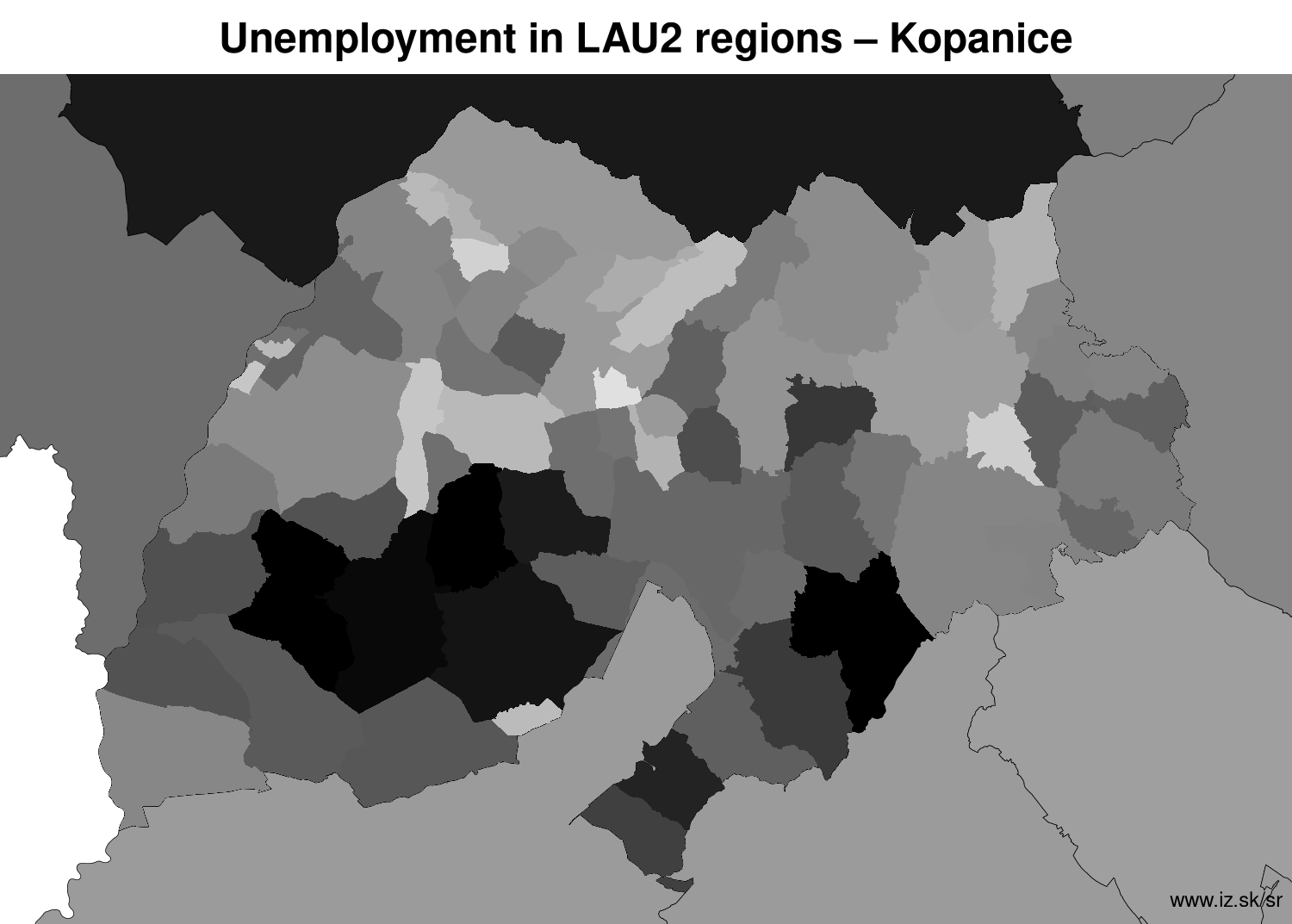
| rok | 2012 | 2014 | 2016 | 2018 | 2019 | 2020 | 2021 | 2022 | 2023 | 2024 | 2025 | 2026 |
|---|---|---|---|---|---|---|---|---|---|---|---|---|
| number of unemployed | 7643 | 7382 | 5066 | 2813 | 2816 | 4096 | 4110 | 3602 | 3418 | 3228 | 3338 | 3412 |
| number of long-term unemployed | 3357 | 3315 | 1876 | 584 | 415 | 648 | 1244 | 1078 | 908 | 852 | 773 | 850 |
| number of people receiving social benefits | 5326 | 4405 | 2176 | 1166 | 1032 | 1111 | 1022 | 1232 | 1228 | 1058 | 994 | 1007 |
| number of activational workers | 319 | 283 | 131 | 41.7 | 38.1 | 44.3 | 38 | 42.7 | 15.9 | 29 | 30.8 | 4.7 |
| unemployment rate | 7.8 | 7.7 | 5.4 | 3.1 | 3.1 | 4.6 | 4.7 | 4.1 | 4 | 3.8 | 3.9 | 4 |
| long-term unemployment rate | 3.4 | 3.4 | 2.0 | 0.6 | 0.5 | 0.7 | 1.4 | 1.2 | 1.1 | 1.0 | 0.9 | 1.0 |
| vacancies | 114 | 178 | 769 | 1936 | 2080 | 1647 | 1976 | 3424 | 2987 | 2233 | 859 | 1193 |
Demographics
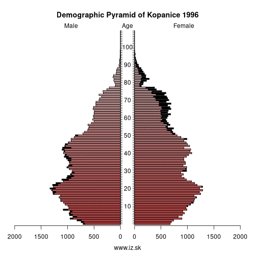
| 2012 | 2014 | 2016 | 2018 | 2019 | 2020 | 2021 | 2022 | 2023 | 2024 | 2025 | 2026 | |
|---|---|---|---|---|---|---|---|---|---|---|---|---|
| number of inhabitants | 134 812 | 134 742 | 134 523 | 134 060 | 133 753 | 133 341 | 132 023 | 131 491 | 130 909 | 130 349 | 129 575 | 129 575 |
| assignation tax | 30 932 363 | 31 747 482 | 38 112 120 | 45 679 446 | 51 941 762 | 53 233 234 | 50 853 577 | 55 987 680 | 62 267 765 | 62 296 635 | 50 238 246 | 53 892 383 |
| demographic dependency | 20.4 | 22.2 | 24.2 | 26.5 | 27.9 | 29.1 | 29.8 | 30.9 | 32 | 33.1 | 34.1 | |
| number of employed foreigners | 226 | 424 | 694 | 1006 | 1302 | 1305 | 1403 | 1584 | 1707 | 1799 | 1829 | 2035 |
Number of unemployed
| rok | 2012 | 2014 | 2016 | 2018 | 2019 | 2020 | 2021 | 2022 | 2023 | 2024 | 2025 | 2026 |
|---|---|---|---|---|---|---|---|---|---|---|---|---|
| less than 24 years | 1923 | 1349 | 777 | 359 | 400 | 618 | 577 | 515 | 504 | 506 | 547 | 542 |
| 25 to 39 years | 3137 | 2616 | 1838 | 1016 | 1027 | 1431 | 1390 | 1214 | 1134 | 1061 | 1074 | 1037 |
| 40 to 54 years | 2791 | 2372 | 1632 | 920 | 918 | 1337 | 1378 | 1236 | 1174 | 1123 | 1175 | 1244 |
| 55 years and more | 1090 | 1044 | 820 | 518 | 470 | 710 | 765 | 637 | 606 | 538 | 542 | 601 |
Other regions
- Basic data on Slovak regions
- Labour market indicators of slovak regions.
- Region Bratislava and surroundings
- Region Kopanice
- Region Danube river
- Region lower Vah river
- Region middle Vár river
- Region upper Nitra river
- Region lower Nitra river
- Region Mining cities
- Region Kysuce a Orava
- Region upper Vah river – Liptov
- Region Spiš cities
- Region upper Hron river
- Region Juhoslovenská kotlina
- Region Košice fold and Torysa river
- Region upper Zemplín
- Region lower Zemplín
Suggested citation: Michal Páleník: Regions of Slovakia - Region Kopanice, IZ Bratislava, retrieved from: https://www.iz.sk/en/projects/regions-of-slovakia/kopanice
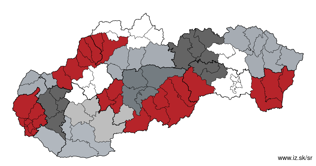
Regions of the Slovak Republic
Due to the need of analysis we have created regions of Slovakia. We will bring more information about these regions from the macroeconomic point of view as well as from the point of view of the labour market.. . .
 Share
Share Facebook
 Twitter
 News
News