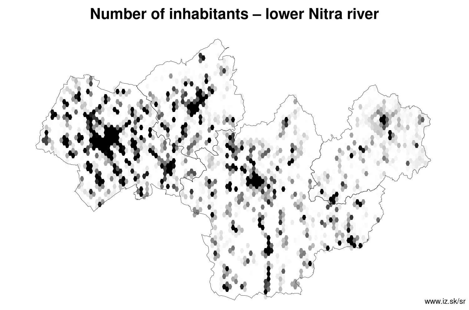
Region lower Nitra river
consists of counties:
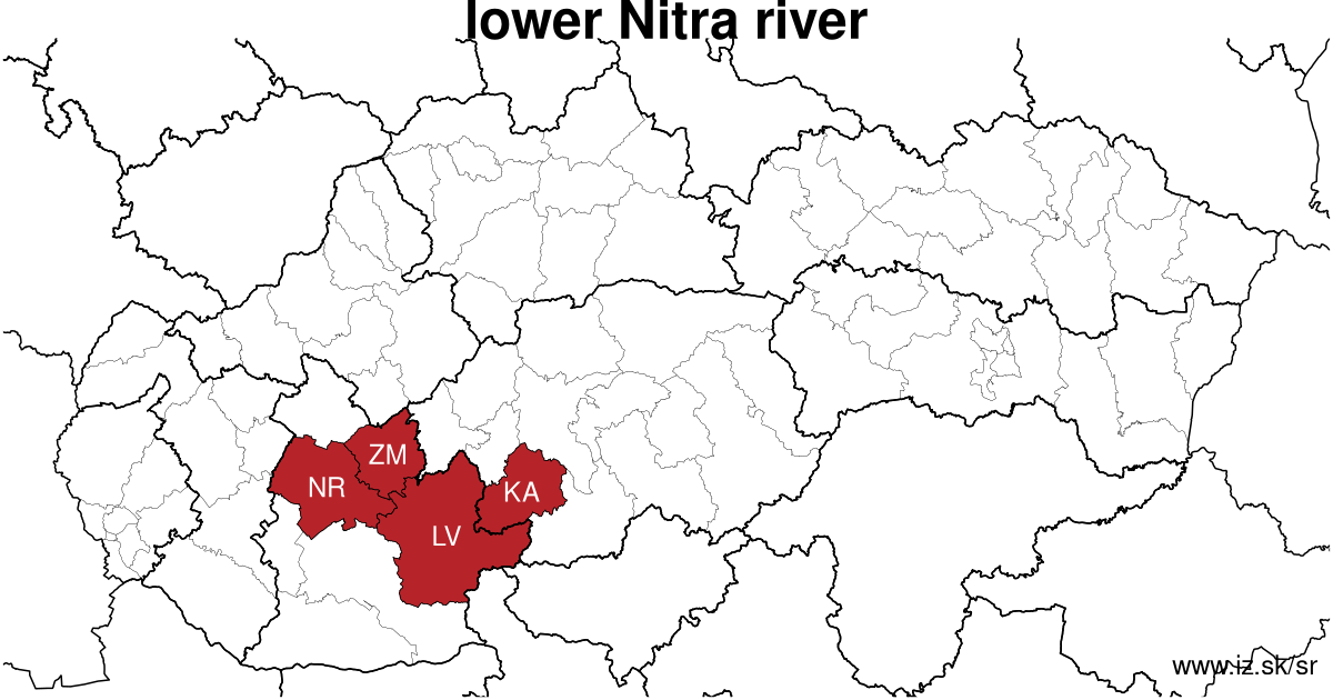
Towns
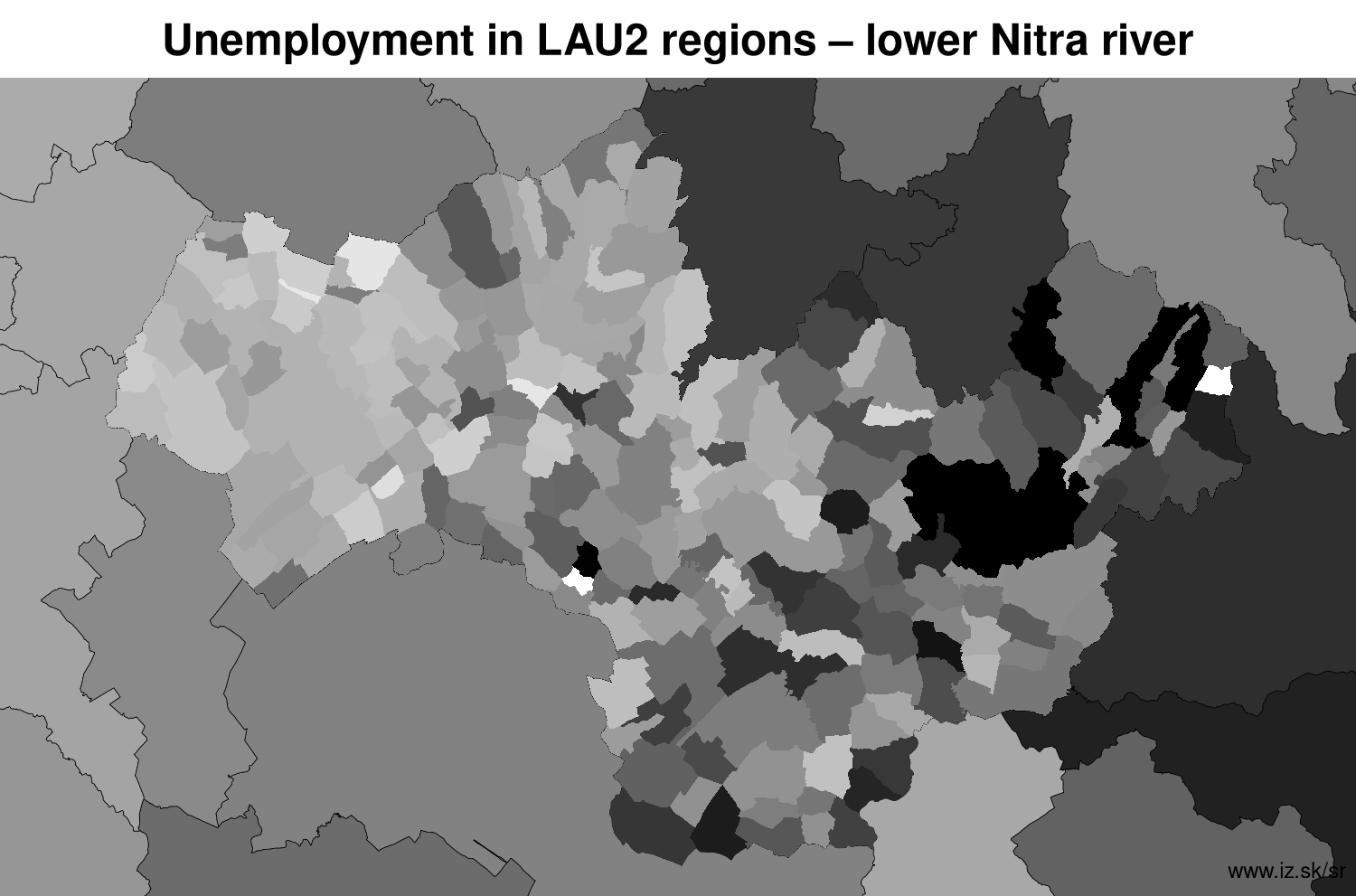
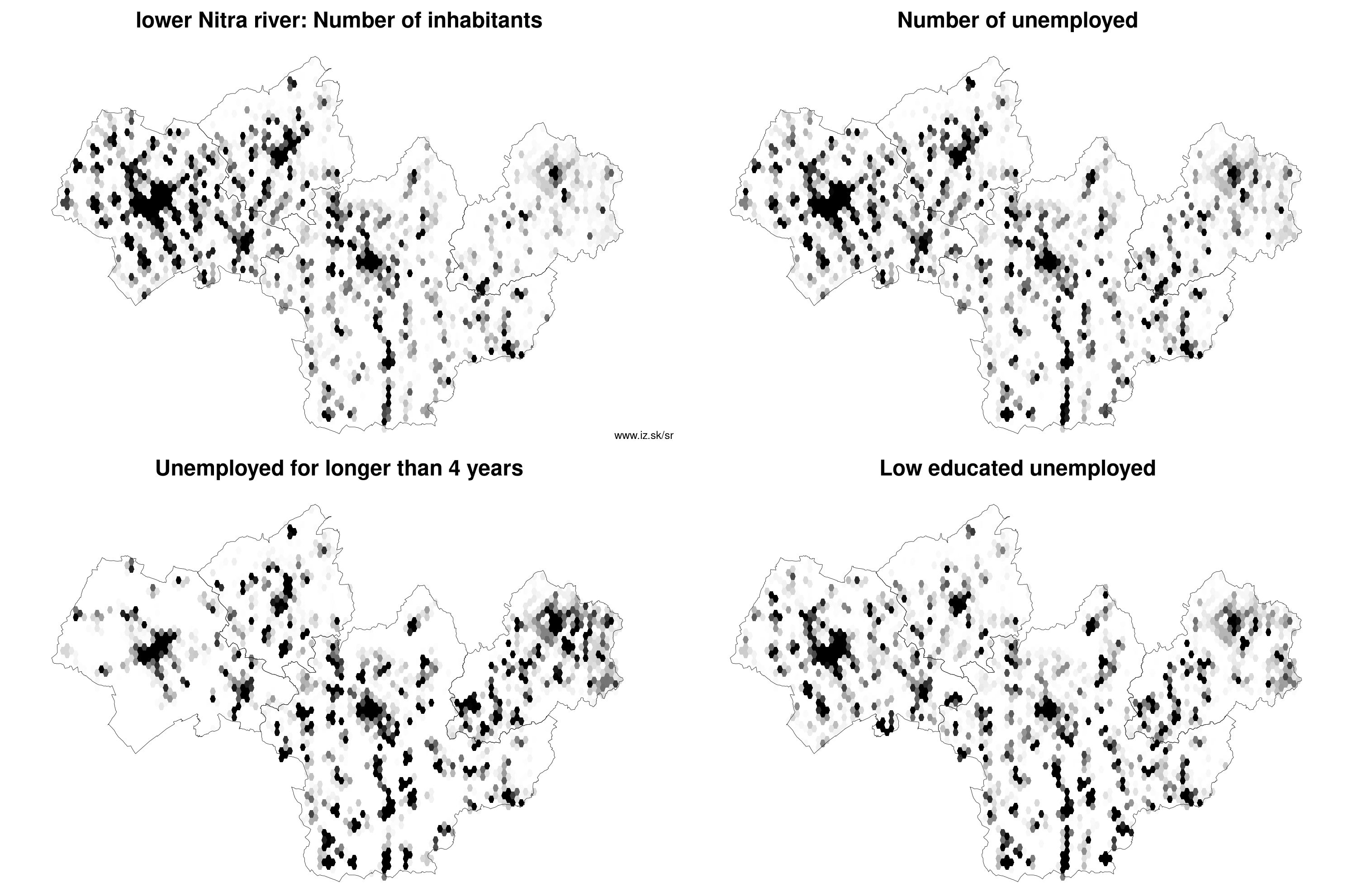
Region lower Nitra river contains cities Dudince, Krupina, Levice, Nitra, Šahy, Tlmače, Vráble, Želiezovce, Zlaté Moravce and 211 villages. Statistics on city level on unemployment are for the period of 2024-02-01, for population are fore yar 2021.
name | number of inhabitants in economically active age | number of unemployed number of unemployed women number of long-term unemployed | unemployment rate unemployment rate of women long-term unemployment rate |
|---|---|---|---|
 Nitra | 77 610 50 737 | 1 111 630 162 | 2.2 % 2.5 % 0.3 % |
 Levice | 31 440 21 293 | 622 385 193 | 2.9 % 3.6 % 0.9 % |
 Zlaté Moravce | 11 811 7 736 | 198 111 34 | 2.6 % 2.9 % 0.4 % |
 Vráble | 8 488 5 817 | 164 102 29 | 2.8 % 3.5 % 0.5 % |
 Krupina | 7 527 5 082 | 218 102 70 | 4.3 % 4.1 % 1.4 % |
 Šahy | 7 160 4 812 | 161 93 59 | 3.3 % 3.9 % 1.2 % |
 Želiezovce | 6 708 4 508 | 185 116 55 | 4.1 % 5.1 % 1.2 % |
 Tlmače | 3 618 2 330 | 62 36 20 | 2.7 % 3.2 % 0.9 % |
 Dudince | 1 365 894 | 29 13 5 | 3.2 % 2.9 % 0.6 % |
Villages with over 2000 inhabitants are Cabaj-Čápor (4342), Veľké Zálužie (4315), Lužianky (3101), Ivanka pri Nitre (2939), Mojmírovce (2938), Tekovské Lužany (2814), Topoľčianky (2676), Lehota (2384), Nitrianske Hrnčiarovce (2302), Zbehy (2229), Branč (2190), Výčapy-Opatovce (2158), Kozárovce (2088), Kalná nad Hronom (2083), Jelenec (2081), Rišňovce (2071), Vinodol (2060), Jarok (2060).
| villages by number of inhabitants | ||||||
|---|---|---|---|---|---|---|
| total | up to 300 | 300 to 500 | 500 to 1000 | 1000 to 1500 | over 1500 | |
| 211 | 48 | 33 | 63 | 37 | 30 | |
Unemployment
| rok | 2012 | 2014 | 2016 | 2018 | 2019 | 2020 | 2021 | 2022 | 2023 |
|---|---|---|---|---|---|---|---|---|---|
| number of unemployed | 23 429 | 21 418 | 15 165 | 7928 | 6540 | 8986 | 9235 | 7490 | 6882 |
| number of long-term unemployed | 10 624 | 10 344 | 7038 | 2581 | 1668 | 1784 | 2728 | 2300 | 1826 |
| number of people receiving social benefits | 20 332 | 17 411 | 11 226 | 7007 | 5796 | 5238 | 4908 | 5344 | 5318 |
| number of activational workers | |||||||||
| unemployment rate | 9.6 | 8.9 | 6.4 | 3.4 | 2.9 | 4 | 4.1 | 3.4 | 3.1 |
| long-term unemployment rate | 4.4 | 4.3 | 3.0 | 1.1 | 0.7 | 0.8 | 1.2 | 1.0 | 0.8 |
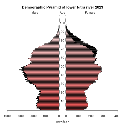
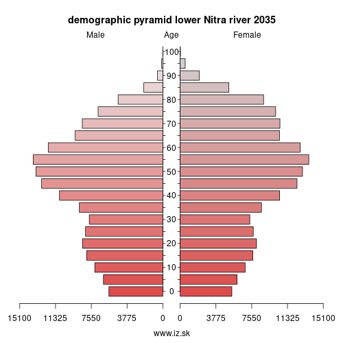
Demographics
| 2012 | 2014 | 2016 | 2018 | 2019 | 2020 | 2021 | 2022 | 2023 | |
|---|---|---|---|---|---|---|---|---|---|
| number of inhabitants | 338 431 | 337 515 | 336 331 | 335 424 | 334 853 | 333 958 | 336 415 | 335 800 | 335 800 |
| assignation tax | 71 777 277 | 75 074 837 | 90 044 509 | 109 471 319 | 123 496 580 | 127 607 948 | 122 550 600 | 135 776 203 | 153 459 410 |
| demographic dependency | 21.5 | 22.8 | 24.7 | 27.0 | 28.2 | 29.3 | 29.7 | 30.8 | 32.5 |
| number of employed foreigners | 545 | 847 | 1788 | 3916 | 6031 | 6902 | 6743 | 7800 | 9002 |
Number of unemployed
| rok | 2012 | 2014 | 2016 | 2018 | 2019 | 2020 | 2021 | 2022 | 2023 |
|---|---|---|---|---|---|---|---|---|---|
| less than 24 years | 5014 | 3524 | 1963 | 906 | 764 | 1144 | 1073 | 829 | 806 |
| 25 to 39 years | 9672 | 7565 | 5208 | 2607 | 2201 | 3108 | 3026 | 2491 | 2219 |
| 40 to 54 years | 8909 | 7324 | 5405 | 2808 | 2235 | 2987 | 3236 | 2643 | 2465 |
| 55 years and more | 3250 | 3006 | 2590 | 1607 | 1340 | 1747 | 1899 | 1526 | 1392 |
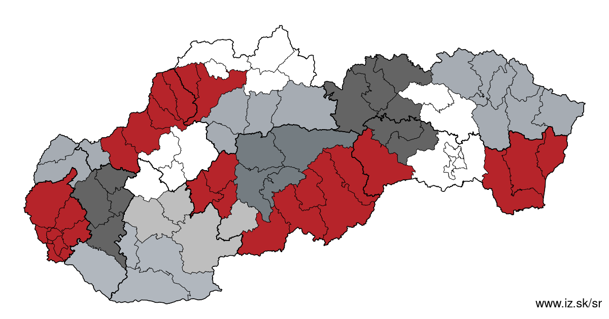
Other regions
- Basic data on Slovak regions
- Labour market indicators of slovak regions.
- Region Bratislava and surroundings
- Region Kopanice
- Region Danube river
- Region lower Vah river
- Region middle Vár river
- Region upper Nitra river
- Region lower Nitra river
- Region Mining cities
- Region Kysuce a Orava
- Region upper Vah river – Liptov
- Region Spiš cities
- Region upper Hron river
- Region Juhoslovenská kotlina
- Region Košice fold and Torysa river
- Region upper Zemplín
- Region lower Zemplín
Suggested citation: Michal Páleník: Regions of Slovakia - Region lower Nitra river, IZ Bratislava, retrieved from: https://www.iz.sk/en/projects/regions-of-slovakia/lower-nitra-river
Regions of the Slovak Republic
Due to the need of analysis we have created regions of Slovakia. We will bring more information about these regions from the macroeconomic point of view as well as from the point of view of the labour market.. . .
 Share
Share Facebook
 Twitter
 News
News