Region lower Vah river
consists of counties:
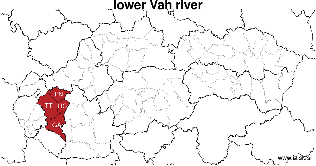
Towns
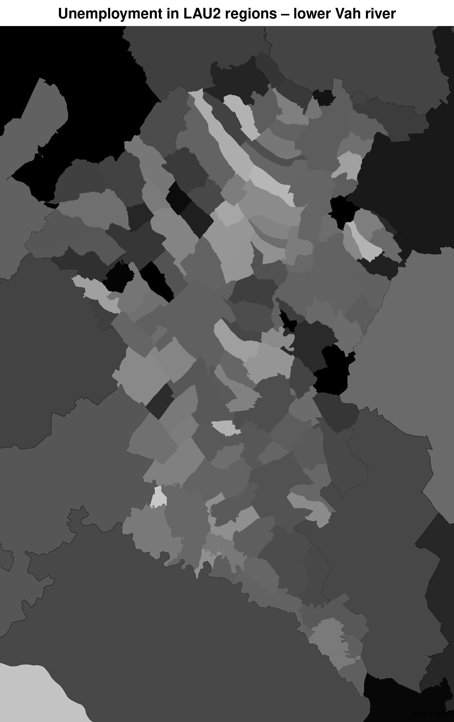
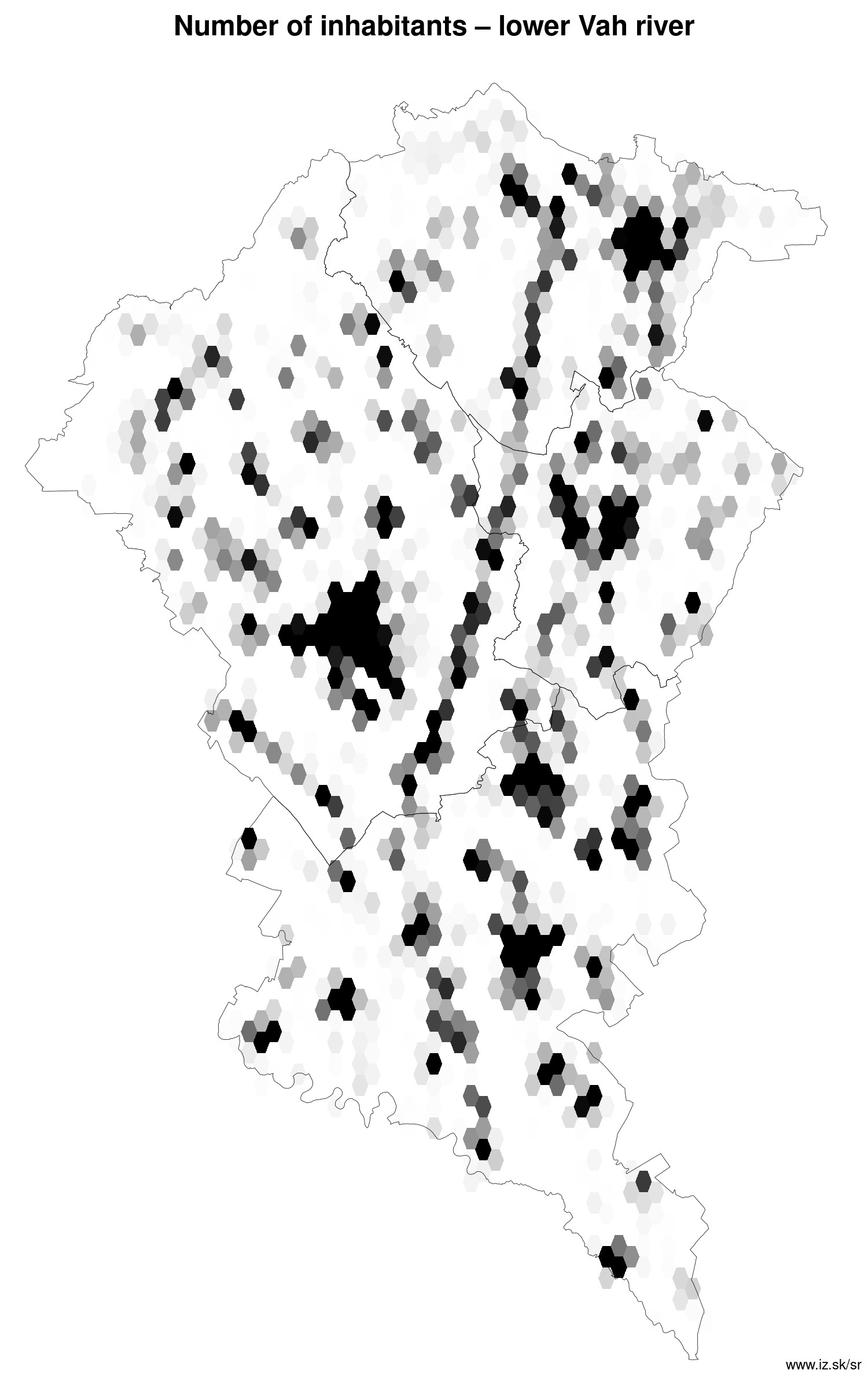
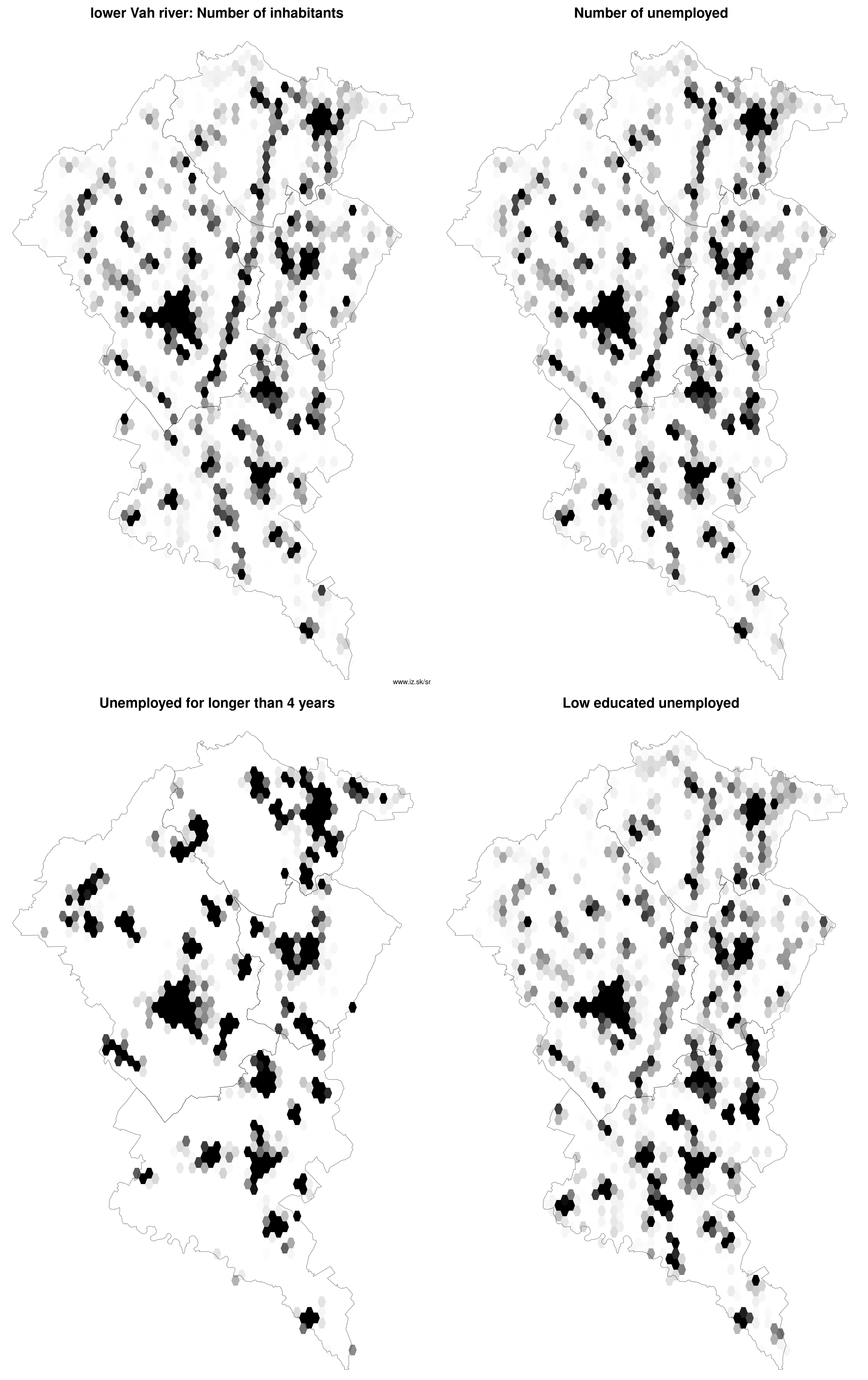
Region lower Vah river contains cities Galanta, Hlohovec, Leopoldov, Piešťany, Sereď, Sládkovičovo, Trnava, Vrbové and 124 villages. Statistics on city level on unemployment are for the period of 2024-02-01, for population are fore yar 2021.
name | number of inhabitants in economically active age | number of unemployed number of unemployed women number of long-term unemployed | unemployment rate unemployment rate of women long-term unemployment rate |
|---|---|---|---|
 Trnava | 63 194 41 248 | 1 047 579 158 | 2.5 % 2.8 % 0.4 % |
 Piešťany | 27 307 17 094 | 444 242 80 | 2.6 % 2.8 % 0.5 % |
 Hlohovec | 20 274 13 409 | 294 174 56 | 2.2 % 2.6 % 0.4 % |
 Sereď | 15 501 10 525 | 294 161 54 | 2.8 % 3.1 % 0.5 % |
 Galanta | 15 098 10 276 | 246 134 48 | 2.4 % 2.6 % 0.5 % |
 Vrbové | 5 698 3 925 | 97 53 20 | 2.5 % 2.7 % 0.5 % |
 Sládkovičovo | 5 390 3 693 | 100 52 13 | 2.7 % 2.8 % 0.4 % |
 Leopoldov | 3 944 2 632 | 47 24 7 | 1.8 % 1.9 % 0.3 % |
Villages with over 2000 inhabitants are Veľké Úľany (4780), Cífer (4610), Šoporňa (4113), Jelka (4026), Trstice (3876), Špačince (3266), Pata (3241), Smolenice (3240), Horné Saliby (3190), Veľké Kostoľany (2799), Zeleneč (2637), Drahovce (2608), Veľká Mača (2602), Brestovany (2594), Chtelnica (2537), Biely Kostol (2477), Moravany nad Váhom (2456), Dolná Krupá (2453), Zavar (2396), Bučany (2390), Jaslovské Bohunice (2360), Boleráz (2349), Madunice (2282), Suchá nad Parnou (2275), Matúškovo (2274), Šúrovce (2233), Hrnčiarovce nad Parnou (2232), Majcichov (2213), Banka (2138), Váhovce (2072), Dvorníky (2029), Dolné Saliby (2012).
| villages by number of inhabitants | ||||||
|---|---|---|---|---|---|---|
| total | up to 300 | 300 to 500 | 500 to 1000 | 1000 to 1500 | over 1500 | |
| 124 | 2 | 18 | 33 | 22 | 49 | |
Unemployment
| rok | 2012 | 2014 | 2016 | 2018 | 2019 | 2020 | 2021 | 2022 | 2023 |
|---|---|---|---|---|---|---|---|---|---|
| number of unemployed | 14 331 | 13 218 | 8760 | 4692 | 4760 | 7350 | 7730 | 6235 | 5740 |
| number of long-term unemployed | 4297 | 4490 | 2248 | 603 | 466 | 765 | 1740 | 1358 | 994 |
| number of people receiving social benefits | 9513 | 7813 | 4632 | 2785 | 2276 | 2175 | 2115 | 2618 | 2588 |
| number of activational workers | |||||||||
| unemployment rate | 6 | 5.6 | 3.8 | 2 | 2.1 | 3.3 | 3.5 | 2.8 | 2.6 |
| long-term unemployment rate | 1.8 | 1.9 | 1.0 | 0.3 | 0.2 | 0.3 | 0.8 | 0.6 | 0.5 |
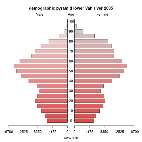
Demographics
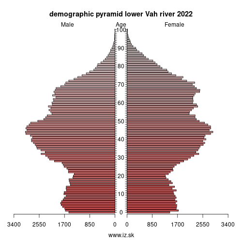
| 2012 | 2014 | 2016 | 2018 | 2019 | 2020 | 2021 | 2022 | 2023 | |
|---|---|---|---|---|---|---|---|---|---|
| number of inhabitants | 331 716 | 332 519 | 333 377 | 334 096 | 334 595 | 334 690 | 333 398 | 333 197 | 333 197 |
| assignation tax | 69 178 478 | 72 810 372 | 88 367 340 | 108 964 831 | 123 456 974 | 128 272 108 | 123 200 087 | 136 397 218 | 153 364 302 |
| demographic dependency | 20.9 | 22.4 | 24.4 | 26.5 | 27.7 | 28.9 | 29.5 | 30.4 | 33.1 |
| number of employed foreigners | 1605 | 1701 | 4718 | 12 078 | 11 603 | 11 539 | 8341 | 10 158 | 11 971 |
Number of unemployed
| rok | 2012 | 2014 | 2016 | 2018 | 2019 | 2020 | 2021 | 2022 | 2023 |
|---|---|---|---|---|---|---|---|---|---|
| less than 24 years | 3436 | 2522 | 1324 | 586 | 570 | 940 | 902 | 735 | 699 |
| 25 to 39 years | 5933 | 4752 | 3246 | 1838 | 1859 | 2810 | 2733 | 2233 | 1986 |
| 40 to 54 years | 4995 | 4063 | 2754 | 1454 | 1532 | 2411 | 2660 | 2120 | 2007 |
| 55 years and more | 1976 | 1881 | 1437 | 814 | 799 | 1188 | 1435 | 1147 | 1049 |
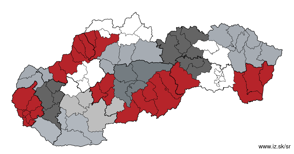
Other regions
- Basic data on Slovak regions
- Labour market indicators of slovak regions.
- Region Bratislava and surroundings
- Region Kopanice
- Region Danube river
- Region lower Vah river
- Region middle Vár river
- Region upper Nitra river
- Region lower Nitra river
- Region Mining cities
- Region Kysuce a Orava
- Region upper Vah river – Liptov
- Region Spiš cities
- Region upper Hron river
- Region Juhoslovenská kotlina
- Region Košice fold and Torysa river
- Region upper Zemplín
- Region lower Zemplín
Suggested citation: Michal Páleník: Regions of Slovakia - Region lower Vah river, IZ Bratislava, retrieved from: https://www.iz.sk/en/projects/regions-of-slovakia/lower-vah-river
Regions of the Slovak Republic
Due to the need of analysis we have created regions of Slovakia. We will bring more information about these regions from the macroeconomic point of view as well as from the point of view of the labour market.. . .
 Share
Share Facebook
 Twitter
 News
News