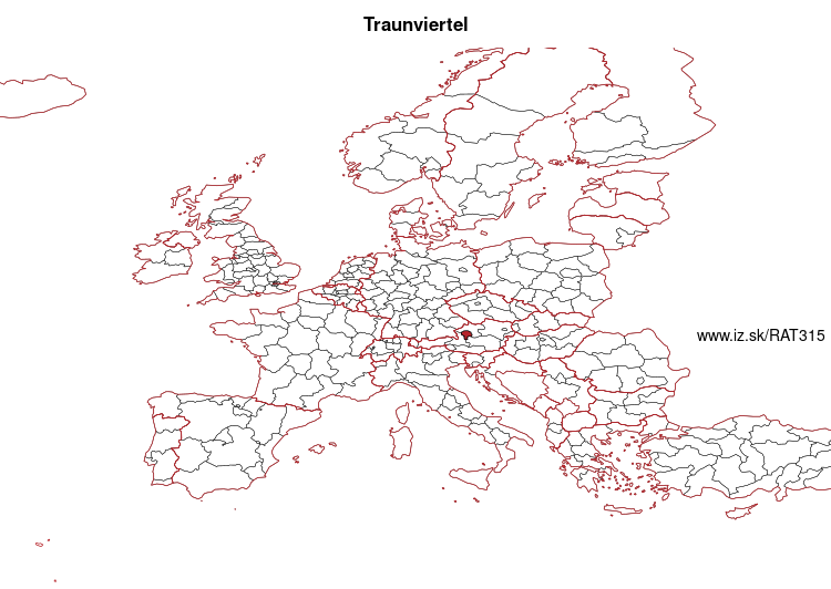
Traunviertel – AT315
EU regions: Austria > Western Austria > Upper Austria > Traunviertel
| Indicator | Period | Value |
|---|---|---|
| Gross domestic product | ||
| GDP per capita in PPS of EU average | 2023 | 104 |
Traunviertel slovensky: AT315
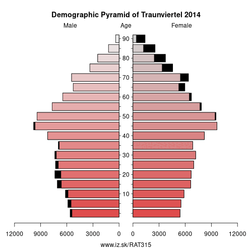
Demographics
| Indicator | Period | Value |
|---|---|---|
| Demographics | ||
| number of inhabitants | 2025 | 245 143 |
| population density | 2024 | 102.5 |
| old-age dependency ratio | 2025 | 33.5 |
From Wikipedia : The Traunviertel (literally German for the Traun quarter or district) is an Austrian region belonging to the state of Upper Austria: it is one of four „quarters" of Upper Austria the others being Hausruckviertel, Mühlviertel, and Innviertel. Its name refers to the river Traun which passes through the area.
Region
The region is equivalent with the Austrian political districts of Linz-Land, Steyr-Land, Kirchdorf, Gmunden, Steyr and the city of Linz (only the parts south of river Danube.
Other: Upper Austria, Innviertel, Linz-Wels, Steyr-Kirchdorf, Traunviertel, Mühlviertel
Neighbours: Salzburg und Umgebung, Innviertel, Liezen District, Pinzgau-Pongau, Linz-Wels, Steyr-Kirchdorf
Suggested citation: Michal Páleník: Europe and its regions in numbers - Traunviertel – AT315, IZ Bratislava, retrieved from: https://www.iz.sk/PAT315, ISBN: 978-80-970204-9-1, DOI:10.5281/zenodo.10200164
 Share
Share Facebook
 Twitter
 News
News