- About us»
- Net income calculator»
- Population aging»
-
-
- Unemployment structure in the Visegrad region
- Development in least developed regions
- Statistics of the least developed regions in Slovakia
- Detailed statistics of least developed regions in Slovakia
-
- Average wage
- Material need benefits
- Meal allowance
- Counties of Slovakia
- Inflation
- Living and Subsistence Minimum
- Unemployment of Czechia and Slovakia
- NACE Classification
-
- Life expectancy
- Gender differences
- Youth unemployment and NEET
- Minimum wage in EU
- Unemployment rates of different age groups
- Share of salaries on GDP
- Long term unemployment
- Percentage of employees ususally working at nights
- Employment rate
- NEET
- Unemployment rate
-
- Bratislava and surroundings
- Kopanice
- Danube river
- lower Vah river
- middle Vár river
- upper Nitra river
- lower Nitra river
- Mining cities
- Kysuce a Orava
- upper Vah river - Liptov
- Spiš cities
- upper Hron river
- Juhoslovenská kotlina
- Košice fold and Torysa river
- upper Zemplín
- lower Zemplín
- EU regions
- NUTS3 regions of Slovakia
- LAU1 dataset
-
-
- Projects and activities
- Inclusive growth»
- Good work
- Project SKRS
- Social system – reality and vision
- Library
-
- Education of unemployed
- Young unemployed not taking part in education
- Proposal to change the system of education funding
- News»
- Contact
Lanzarote – ES708
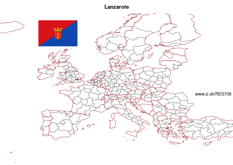
EU regions: Spain > Canary Islands > Canarias > Lanzarote

| Indicator | Period | Value |
|---|---|---|
| Gross domestic product | ||
| GDP per capita in PPS of EU average | 2022 | 74 |
Lanzarote slovensky: ES708
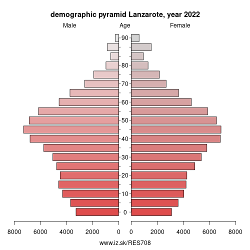
Demographics
| Indicator | Period | Value |
|---|---|---|
| Demographics | ||
| number of inhabitants | 2025 | 166 878 |
| population density | 2023 | 191.2 |
| old-age dependency ratio | 2025 | 19.6 |

From Wikipedia :
Lanzarote (UK: , Spanish: [lanθaˈɾote], locally [lansaˈɾote]) is a Spanish island, the northernmost and easternmost of the autonomous Canary Islands in the Atlantic Ocean. It is located approximately 125 kilometres (78 miles) off the north coast of Africa and 1,000 kilometres (621 miles) from the Iberian Peninsula. Covering 845.94 square kilometres (326.62 square miles), Lanzarote is the fourth-largest of the islands in the archipelago. With 149183 inhabitants, it is the third most populous Canary Island, after Tenerife and Gran Canaria. Located in the centre-west of the island is Timanfaya National Park, one of its main attractions. The island was declared a biosphere reserve by UNESCO in 1993. The island's capital is Arrecife.The first recorded name for the island, given by Italian-Majorcan cartographer Angelino Dulcert, was Insula de Lanzarotus Marocelus, after the Genoese navigator Lancelotto Malocello, from which the modern name is derived. The island's name in the native language was Tyterogaka or Tytheroygaka, which may mean „one that is all ochre" (referring to the island's predominant colour).
Geography
Lanzarote is located 11 kilometres (7 miles) north-east of Fuerteventura and just over 1 kilometre (0.62 miles) from Graciosa. The dimensions of the island are 60 kilometres (37 miles) from north to south and 25 kilometres (16 miles) from west to east.
Other: Canarias, Gran Canaria, La Gomera, Lanzarote, Tenerife, Fuerteventura, El Hierro, La Palma
Suggested citation: Michal Páleník: Europe and its regions in numbers - Lanzarote – ES708, IZ Bratislava, retrieved from: https://www.iz.sk/PES708, ISBN: 978-80-970204-9-1, DOI:10.5281/zenodo.10200164

 Share
Share Facebook
 Twitter
 News
News