- About us»
- Net income calculator»
- Population aging»
-
-
- Unemployment structure in the Visegrad region
- Development in least developed regions
- Detailed statistics of least developed regions in Slovakia
- Statistics of the least developed regions in Slovakia
-
- Average wage
- Material need benefits
- Meal allowance
- Counties of Slovakia
- Inflation
- Living and Subsistence Minimum
- Unemployment of Czechia and Slovakia
- NACE Classification
-
- Life expectancy
- Gender differences
- Youth unemployment and NEET
- Minimum wage in EU
- Unemployment rates of different age groups
- Share of salaries on GDP
- Long term unemployment
- Unemployment rate
- Percentage of employees ususally working at nights
- NEET
- Employment rate
-
- Bratislava and surroundings
- Kopanice
- Danube river
- lower Vah river
- middle Vár river
- upper Nitra river
- lower Nitra river
- Mining cities
- Kysuce a Orava
- upper Vah river - Liptov
- Spiš cities
- upper Hron river
- Juhoslovenská kotlina
- Košice fold and Torysa river
- upper Zemplín
- lower Zemplín
- EU regions
- NUTS3 regions of Slovakia
- LAU1 dataset
-
-
- Projects and activities
- Inclusive growth»
- Good work
- Project SKRS
- Social system – reality and vision
-
- Education of unemployed
- Young unemployed not taking part in education
- Proposal to change the system of education funding
- Library
- News»
- Contact
Thurrock – UKH32
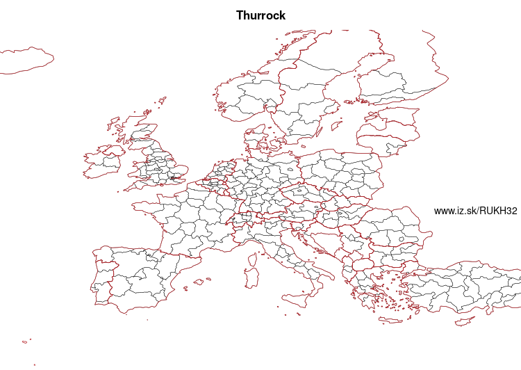
EU regions: United Kingdom > East of England > Essex > Thurrock

| Indicator | Period | Value |
|---|
Thurrock slovensky: UKH32
Demographics
| Indicator | Period | Value |
|---|---|---|
| Demographics | ||
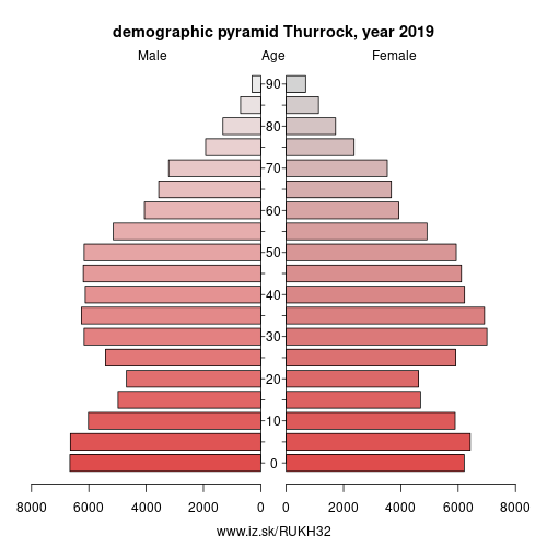
| number of inhabitants | 2019 | 173 405 |
| population density | 2018 | 1057.8 |
| old-age dependency ratio | 2019 | 21.6 |

From Wikipedia :
Thurrock () is a unitary authority area with borough status in the English ceremonial county of Essex. It is part of the London commuter belt and an area of regeneration within the Thames Gateway redevelopment zone. The local authority is Thurrock Council.The borough
It lies on the River Thames just to the east of London. With over 18 miles (29 km) of riverfront it covers an area of 64 square miles (170 km2), with more than half defined as Green Belt. With Greater London to the west and the river to the south, the county of Essex abuts the Borough to the north and east, and across the river lies Kent.
Politics
The local authority is Thurrock Council. Elections are held 3 out of every 4 years. In 2016, the Conservative Party took control of the council, albeit as a minority-party administration.
Thurrock is covered by two parliamentary constituencies.
Other: Essex, Southend-on-Sea, Thurrock, West Essex, Heart of Essex, Essex Thames Gateway, Essex Haven Gateway
Neighbours: Essex Thames Gateway, Heart of Essex, Barking & Dagenham and Havering
Suggested citation: Michal Páleník: Europe and its regions in numbers - Thurrock – UKH32, IZ Bratislava, retrieved from: https://www.iz.sk/PUKH32, ISBN: 978-80-970204-9-1, DOI:10.5281/zenodo.10200164

 Share
Share Facebook
 Twitter
 News
News