- About us»
- Net income calculator»
- Population aging»
-
-
- Unemployment structure in the Visegrad region
- Development in least developed regions
- Statistics of the least developed regions in Slovakia
- Detailed statistics of least developed regions in Slovakia
-
- Average wage
- Material need benefits
- Meal allowance
- Counties of Slovakia
- Inflation
- Living and Subsistence Minimum
- Unemployment of Czechia and Slovakia
- NACE Classification
-
- Life expectancy
- Gender differences
- Youth unemployment and NEET
- Minimum wage in EU
- Unemployment rates of different age groups
- Share of salaries on GDP
- Unemployment rate
- Percentage of employees ususally working at nights
- Employment rate
- NEET
- Long term unemployment
-
- Bratislava and surroundings
- Kopanice
- Danube river
- lower Vah river
- middle Vár river
- upper Nitra river
- lower Nitra river
- Mining cities
- Kysuce a Orava
- upper Vah river - Liptov
- Spiš cities
- upper Hron river
- Juhoslovenská kotlina
- Košice fold and Torysa river
- upper Zemplín
- lower Zemplín
- EU regions
- NUTS3 regions of Slovakia
- LAU1 dataset
-
-
- Projects and activities
- Inclusive growth»
- Good work
- Project SKRS
- Social system – reality and vision
- Library
-
- Education of unemployed
- Young unemployed not taking part in education
- Proposal to change the system of education funding
- News»
- Contact
Buckinghamshire – UKJ13
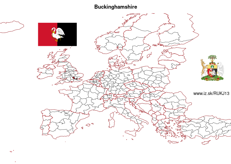
EU regions: United Kingdom > South East England > Berkshire, Buckinghamshire and Oxfordshire > Buckinghamshire

| Indicator | Period | Value |
|---|
Buckinghamshire slovensky: UKJ13
Demographics
| Indicator | Period | Value |
|---|---|---|
| Demographics | ||
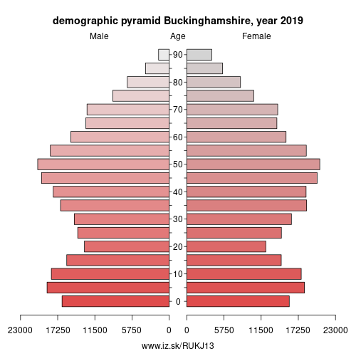
| number of inhabitants | 2019 | 543 128 |
| population density | 2018 | 345.7 |
| old-age dependency ratio | 2019 | 30.5 |

From Wikipedia :
Buckinghamshire (), abbreviated Bucks, is a ceremonial county in South East England which borders Greater London to the south east, Berkshire to the south, Oxfordshire to the west, Northamptonshire to the north, Bedfordshire to the north east and Hertfordshire to the east.Buckinghamshire is one of the home counties and towns such as High Wycombe, Amersham, Chesham and the Chalfonts in the east and southeast of the county are parts of the London commuter belt, forming some of the most densely populated parts of the county. Development in this region is restricted by the Metropolitan Green Belt. Other large settlements include the county town of Aylesbury, Marlow in the south near the Thames and Princes Risborough in the west near Oxford. Some areas without direct rail links to London, such as around the old county town of Buckingham and near Olney in the northeast, are much less populous. The largest town is Milton Keynes in the northeast, which with the surrounding area is administered as a unitary authority separately to the rest of Buckinghamshire. The remainder of the county is administered by Buckinghamshire County Council as a non-metropolitan county, and four district councils. In national elections, Buckinghamshire is considered a reliable supporter of the Conservative Party.
A large part of the Chiltern Hills, an Area of Outstanding Natural Beauty, runs through the south of the county and attracts many walkers and cyclists from London. In this area older buildings are often made from local flint and red brick.
Other: Berkshire, Buckinghamshire and Oxfordshire, Milton Keynes, Berkshire, Oxfordshire, Buckinghamshire
Neighbours: Milton Keynes, Berkshire, Central Bedfordshire, Oxfordshire, Harrow and Hillingdon, West Northamptonshire, Hertfordshire
Suggested citation: Michal Páleník: Europe and its regions in numbers - Buckinghamshire – UKJ13, IZ Bratislava, retrieved from: https://www.iz.sk/PUKJ13, ISBN: 978-80-970204-9-1, DOI:10.5281/zenodo.10200164

 Share
Share Facebook
 Twitter
 News
News