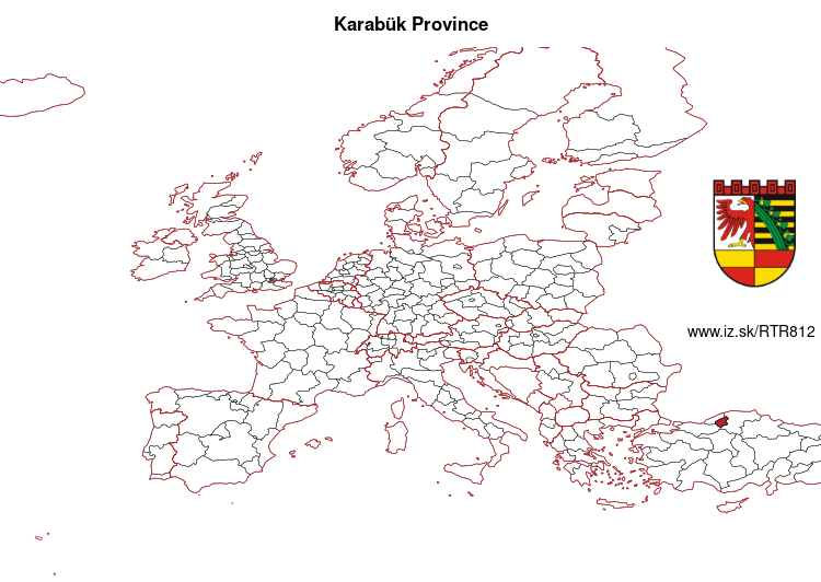
-
- Objectives
- Team»
- Partners»
- IZ offers
- IZ in media
- Conferences
- Net income calculator»
- Population aging»
-
- Least developed regions»
-
- Material need benefits
- Meal allowance
- Counties of Slovakia
- Average wage and inflation
- Living and Subsistence Minimum
- Unemployment of Czechia and Slovakia
- NACE Classification
-
- Youth unemployment and NEET
- Minimum wage in EU
- Unemployment rates of different age groups
- Share of salaries on GDP
- Aggregate replacement ratio
- People at risk of poverty or social exclusion
- Employment of mothers of more than 3 children
- Percentage of employees ususally working on Sunday
- Percentage of employees ususally working at nights
- NEET
- Unemployment rate - over 55 years
- Employment rate
- Working hours on full time job
- Long term unemployment
- Unemployment rate
-
- Bratislava and surroundings
- Kopanice
- Danube river
- lower Vah river
- middle Vár river
- upper Nitra river
- lower Nitra river
- Mining cities
- Kysuce a Orava»
- upper Vah river - Liptov
- Spiš cities
- upper Hron river
- Juhoslovenská kotlina
- Košice fold and Torysa river
- upper Zemplín
- lower Zemplín
- EU regions
- NUTS3 regions of Slovakia
- LAU1 dataset
-
- Projects and activities
- Inclusive growth»
- Good work
- Project SKRS
- Social system – reality and vision
- Library
-
- Education of unemployed
- Young unemployed not taking part in education
- Proposal to change the system of education funding
- News»
- Contact
Karabük Province - TR812
EU regions: Turkey > West Black Sea Region (statistical) > Zonguldak Subregion > Karabük Province


indicator | period | value |
---|---|---|
GDP per capita in PPS of EU average | 2021 | 51 |
number of inhabitants | 2021 | 243 614 |
population density | 2019 | 60.8 |
old-age dependency ratio | 2021 | 20.2 |
more on wikipedia * more on wikidata Q483168 * Karabük Province slovensky: TR812
Composition of population according to age group, education and economic activity, Karabük Province
age group | low education | middle education | high education |
---|
note: in thousands, according to labour force sample survey. P – total population, E – employed, U – unemployed, I – number of ecnomically inactive

From wikipedia:
Dessau is a town and former municipality in Germany on the junction of the rivers Mulde and Elbe, in the Bundesland (Federal State) of Saxony-Anhalt. Since 1 July 2007, it has been part of the newly created municipality of Dessau-Roßlau. Population of Dessau proper: 77,973 (June 2006).Geography
Dessau is situated on a floodplain where the Mulde flows into the Elbe. This causes yearly floods. The worst flood took place in the year 2002, when the Waldersee district was nearly completely flooded. The south of Dessau touches a well-wooded area called Mosigkauer Heide. The highest elevation is a 110 m high former rubbish dump called Scherbelberg in the southwest of Dessau. Dessau is surrounded by numerous parks and palaces that make it one of the greenest towns in Germany.
History
Dessau was first mentioned in 1213.
other: Zonguldak Subregion, Bartın Province, Karabük Province, Zonguldak Province
neighbours: Bolu Province, Bartın Province, Kastamonu Province, Zonguldak Province, Çankırı Province
Suggested citation: Michal Páleník: EU regions - Karabük Province - TR812, IZ Bratislava, retrieved from: https://www.iz.sk/en/projects/eu-regions/TR812
Similar articles
Navigation:
- Short news
- Local Administrative Units data open data
- Projects and activities
- European regions
- Random region: Germany, Saxony, Dresden Directorate District, Meissen District