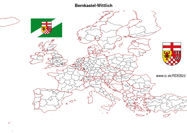
Bernkastel-Wittlich – DEB22
EU regions: Germany > Rhineland-Palatinate > Trier Government Region > Bernkastel-Wittlich
| Indicator | Period | Value |
|---|---|---|
| Gross domestic product | ||
| GDP per capita in PPS of EU average | 2023 | 93 |
Bernkastel-Wittlich slovensky: DEB22
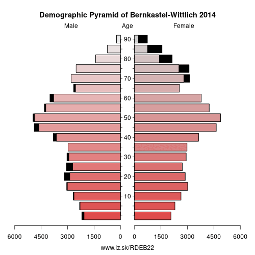
Demographics
| Indicator | Period | Value |
|---|---|---|
| Demographics | ||
| number of inhabitants | 2025 | 113 187 |
| population density | 2024 | 97.8 |
| old-age dependency ratio | 2025 | 39.7 |
From Wikipedia : Bernkastel-Wittlich (German: Landkreis Bernkastel-Wittlich) is a district in Rhineland-Palatinate, Germany. It is bounded by (from the north and clockwise) the districts of Vulkaneifel, Cochem-Zell, Rhein-Hunsrück, Birkenfeld, Trier-Saarburg and Bitburg-Prüm.
History
The district was established in 1969 by merging the former districts of Bernkastel and Wittlich.
Geography
The district is situated on both banks of the Moselle, which crosses the territory from southwest to northeast. The country rises to the Eifel in the north and the Hunsrück in the south. A great number of tributaries rise in the Eifel and flow into the Moselle. In the very south of the district is the Erbeskopf (818 m), the highest peak in the Hunsrück and Rhineland-Palatinate.
Coat of arms
Towns and municipalities
Twin region
At one time, the Borough of Milton Keynes was the twinned region of the district of Bernkastel-Wittlich.
Other: Trier Government Region, Eifelkreis Bitburg-Prüm, Trier, Trier-Saarburg, Vulkaneifel, Bernkastel-Wittlich
Neighbours: Eifelkreis Bitburg-Prüm, Vulkaneifel, Trier-Saarburg, Cochem-Zell, Birkenfeld, Rhein-Hunsrück-Kreis
Suggested citation: Michal Páleník: Europe and its regions in numbers - Bernkastel-Wittlich – DEB22, IZ Bratislava, retrieved from: https://www.iz.sk/PDEB22, ISBN: 978-80-970204-9-1, DOI:10.5281/zenodo.10200164
 Share
Share Facebook
 Twitter
 News
News