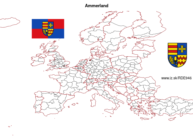
Ammerland – DE946
EU regions: Germany > Lower Saxony > Weser-Ems Government Region > Ammerland
| Indicator | Period | Value |
|---|---|---|
| Gross domestic product | ||
| GDP per capita in PPS of EU average | 2023 | 96 |
Ammerland slovensky: DE946
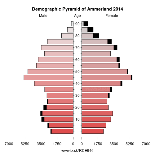
Demographics
| Indicator | Period | Value |
|---|---|---|
| Demographics | ||
| number of inhabitants | 2025 | 127 751 |
| population density | 2024 | 176.1 |
| old-age dependency ratio | 2025 | 40.3 |
From Wikipedia : Ammerland is a district in Lower Saxony, Germany. It is bounded by (from the east and clockwise) the city of Oldenburg and the districts of Oldenburg, Cloppenburg, Leer, Friesland and Wesermarsch.
History
The „Ammerland" was first mentioned in the 10th century. The word is believed to derive from Ameri, which is an old word meaning „swamp“. In the time of Viking raids small ring-like castles were built in order to protect the defenceless hamlets.
For many years there was little interest in this swampy region. In the 14th century it became part of the County of Oldenburg. The counts established strongholds in the region, which was the frontier against the lands of the untamable Frisians.
The district was established in 1933 in the rough borders of the historical region.
Geography
Ammerland is characterised by a very flat countryside, many fens and swamps, and many windmills.
Other: Weser-Ems Government Region, Oldenburg, Oldenburg, Ammerland, Vechta District, Osnabrück District, Cloppenburg, Emsland, County of Bentheim, Delmenhorst, Friesland, Osnabrück, Leer, Wesermarsch, Wilhelmshaven, Emden, Wittmund, Aurich
Neighbours: Leer, Oldenburg, Oldenburg, Friesland, Cloppenburg, Wesermarsch
Suggested citation: Michal Páleník: Europe and its regions in numbers - Ammerland – DE946, IZ Bratislava, retrieved from: https://www.iz.sk/PDE946, ISBN: 978-80-970204-9-1, DOI:10.5281/zenodo.10200164
 Share
Share Facebook
 Twitter
 News
News