- About us»
- Net income calculator»
- Population aging»
-
-
- Unemployment structure in the Visegrad region
- Development in least developed regions
- Detailed statistics of least developed regions in Slovakia
- Statistics of the least developed regions in Slovakia
-
- Average wage
- Material need benefits
- Meal allowance
- Counties of Slovakia
- Inflation
- Living and Subsistence Minimum
- Unemployment of Czechia and Slovakia
- NACE Classification
-
- Life expectancy
- Gender differences
- Youth unemployment and NEET
- Minimum wage in EU
- Unemployment rates of different age groups
- Share of salaries on GDP
- Long term unemployment
- NEET
- Unemployment rate
- Percentage of employees ususally working at nights
- Employment rate
-
- Bratislava and surroundings
- Kopanice
- Danube river
- lower Vah river
- middle Vár river
- upper Nitra river
- lower Nitra river
- Mining cities
- Kysuce a Orava
- upper Vah river - Liptov
- Spiš cities
- upper Hron river
- Juhoslovenská kotlina
- Košice fold and Torysa river
- upper Zemplín
- lower Zemplín
- EU regions
- NUTS3 regions of Slovakia
- LAU1 dataset
-
-
- Projects and activities
- Inclusive growth»
- Good work
- Project SKRS
- Social system – reality and vision
- Library
-
- Education of unemployed
- Young unemployed not taking part in education
- Proposal to change the system of education funding
- News»
- Contact
Sandwell – UKG37
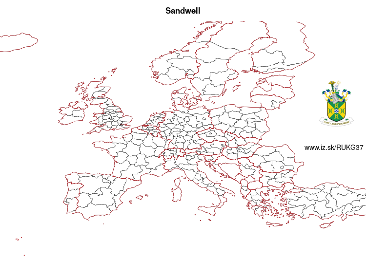
EU regions: United Kingdom > West Midlands > West Midlands > Sandwell

| Indicator | Period | Value |
|---|
Sandwell slovensky: UKG37
Demographics
| Indicator | Period | Value |
|---|---|---|
| Demographics | ||
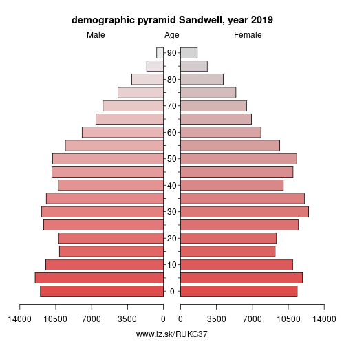
| number of inhabitants | 2019 | 328 774 |
| population density | 2018 | 3811 |
| old-age dependency ratio | 2019 | 23.6 |

From Wikipedia : Sandwell is a metropolitan borough of the West Midlands county in England. The borough is named after the Sandwell Priory, and spans a densely populated part of the West Midlands conurbation. According to Sandwell Metropolitan Borough Council, the borough comprises the six amalgamated towns of Oldbury, Rowley Regis, Smethwick, Tipton, Wednesbury, and West Bromwich, although these places consist of numerous smaller settlements and localities. Though West Bromwich is the largest town in the borough and its designated Strategic Town Centre, Sandwell Council House (the headquarters of the local authority) is situated in Oldbury.
Bordering Sandwell is the City of Birmingham to the east, the Metropolitan Borough of Dudley to the south and west, the Metropolitan Borough of Walsall to the north, and the City of Wolverhampton to the north-west. Spanning the borough are the parliamentary constituencies of West Bromwich West, West Bromwich East, Warley, and part of Halesowen and Rowley Regis, which crosses into the Dudley borough.
At the 2011 census, the borough had a population of 309,000 and an area of 86 square kilometres (33 sq mi).
History and culture
The Metropolitan Borough of Sandwell was formed on 1 April 1974 as an amalgamation of the county boroughs of Warley (ceremonially within Worcestershire) and West Bromwich (ceremonially within Staffordshire), under the Local Government Act 1972. Warley had been formed in 1966 by a merger of the county borough of Smethwick with the municipal boroughs of Rowley Regis and Oldbury; at the same time, West Bromwich had absorbed the boroughs of Tipton and Wednesbury.
For its first 12 years of existence, Sandwell had a two-tier system of local government; Sandwell Council shared power with the West Midlands County Council. In 1986 the county council was abolished, and Sandwell effectively became a unitary authority. The borough is divided into 24 Wards and is represented by 72 ward councillors on the borough council.
Other: West Midlands, Solihull, Coventry, Sandwell, Walsall, Wolverhampton, Birmingham, Dudley
Neighbours: Birmingham, Wolverhampton, Dudley, Walsall
Suggested citation: Michal Páleník: Europe and its regions in numbers - Sandwell – UKG37, IZ Bratislava, retrieved from: https://www.iz.sk/PUKG37, ISBN: 978-80-970204-9-1, DOI:10.5281/zenodo.10200164

 Share
Share Facebook
 Twitter
 News
News