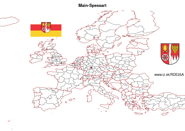
Main-Spessart – DE26A
EU regions: Germany > Bavaria > Lower Franconia > Main-Spessart
| Indicator | Period | Value |
|---|---|---|
| Gross domestic product | ||
| GDP per capita in PPS of EU average | 2023 | 108 |
Main-Spessart slovensky: DE26A
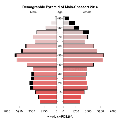
Demographics
| Indicator | Period | Value |
|---|---|---|
| Demographics | ||
| number of inhabitants | 2025 | 125 282 |
| population density | 2024 | 95.6 |
| old-age dependency ratio | 2025 | 41.4 |
From Wikipedia : Main-Spessart is a Landkreis (district) in the northwest of Bavaria, Germany. It is located in Lower Franconia and derives its name from the river Main and the wooded hills of the Spessart.
Geography
The district is bounded by (from the north and clockwise) the districts of Bad Kissingen, Schweinfurt and Würzburg, the state of Baden-Württemberg (district of Main-Tauber), the districts of Miltenberg and Aschaffenburg, and the state of Hesse (district of Main-Kinzig).
The river Main forms a large horse-shoe bend in the district, entering in the southeast near Thüngersheim and leaving to the southwest near Hasloch. In the north it is joined by the Franconian Saale river at Gemünden. The Spessart hills cover most of the area of the district west and north of the Main. To the northeast, the district borders on the Rhön hills.
History
The district was established in 1972 by merging the former districts of Gemünden, Karlstadt, Lohr and Marktheidenfeld. Although Lohr is the largest town, the seat of the administration is located in Karlstadt.
Economy
In 2015 (latest data available) the GDP per inhabitant was €32,436.
Other: Lower Franconia, Schweinfurt, Bad Kissingen district, Main-Spessart, Aschaffenburg district, Rhön-Grabfeld, Würzburg, Würzburg, Kitzingen, Miltenberg, Haßberge, Aschaffenburg, Schweinfurt
Neighbours: Bad Kissingen district, Schweinfurt, Main-Tauber-Kreis, Miltenberg, Aschaffenburg district, Main-Kinzig-Kreis, Würzburg
Suggested citation: Michal Páleník: Europe and its regions in numbers - Main-Spessart – DE26A, IZ Bratislava, retrieved from: https://www.iz.sk/PDE26A, ISBN: 978-80-970204-9-1, DOI:10.5281/zenodo.10200164
 Share
Share Facebook
 Twitter
 News
News