- About us»
- Net income calculator»
- Population aging»
-
-
- Unemployment structure in the Visegrad region
- Development in least developed regions
- Detailed statistics of least developed regions in Slovakia
- Statistics of the least developed regions in Slovakia
-
- Average wage
- Material need benefits
- Meal allowance
- Counties of Slovakia
- Inflation
- Living and Subsistence Minimum
- Unemployment of Czechia and Slovakia
- NACE Classification
-
- Life expectancy
- Gender differences
- Youth unemployment and NEET
- Minimum wage in EU
- Unemployment rates of different age groups
- Share of salaries on GDP
- Long term unemployment
- Unemployment rate
- Percentage of employees ususally working at nights
- NEET
- Employment rate
-
- Bratislava and surroundings
- Kopanice
- Danube river
- lower Vah river
- middle Vár river
- upper Nitra river
- lower Nitra river
- Mining cities
- Kysuce a Orava
- upper Vah river - Liptov
- Spiš cities
- upper Hron river
- Juhoslovenská kotlina
- Košice fold and Torysa river
- upper Zemplín
- lower Zemplín
- EU regions
- NUTS3 regions of Slovakia
- LAU1 dataset
-
-
- Projects and activities
- Inclusive growth»
- Good work
- Project SKRS
- Social system – reality and vision
-
- Education of unemployed
- Young unemployed not taking part in education
- Proposal to change the system of education funding
- Library
- News»
- Contact
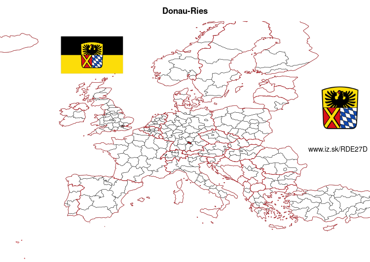
Donau-Ries – DE27D
EU regions: Germany > Bavaria > Swabia > Donau-Ries

| Indicator | Period | Value |
|---|---|---|
| Gross domestic product | ||
| GDP per capita in PPS of EU average | 2022 | 139 |
Donau-Ries slovensky: DE27D
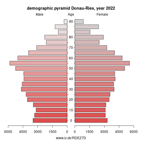
Demographics
| Indicator | Period | Value |
|---|---|---|
| Demographics | ||
| number of inhabitants | 2025 | 135 098 |
| population density | 2023 | 105.9 |
| old-age dependency ratio | 2025 | 34.1 |

From Wikipedia : Donau-Ries (Danube-Ries) is a Landkreis (district) in Swabia, Bavaria, Germany. It is bounded by (from the north and clockwise) the districts of Ansbach, Weißenburg-Gunzenhausen, Eichstätt, Neuburg-Schrobenhausen, Aichach-Friedberg, Augsburg and Dillingen, and by the state of Baden-Württemberg (districts of Heidenheim and Ostalbkreis).
History
From Palaeolithic times on the Nördlinger Ries was a very attractive site for human settlement. The valley of the Danube was abounding with game, and many caves in the slopes of the crater provided shelter for Neanderthals and their successors.
The Ries was always densely populated. From 450 to 15 BC Celtic peoples built their settlements on the tops of the hills. Remains of Celtic circular forts and sanctuaries can be found all over the region. They were replaced about 90 AD by the Romans, who secured the region by building forts and the Limes (which was some km north of the present district).
The Romans were driven away about 250 AD by the Alamanni, which in turn were defeated by the Franks in 496. In the early years of the Holy Roman Empire new castles were erected, among them Oettingen, which was the centre of the county of Oettingen.
Other: Swabia, Memmingen, Ostallgäu, Unterallgäu, Augsburg, Kempten (Allgäu), Landkreis Dillingen an der Donau, Donau-Ries, Oberallgäu, Aichach-Friedberg, Augsburg, Lindau, Neu-Ulm, Kaufbeuren, Günzburg
Neighbours: Ostalbkreis, district Heidenheim, Landkreis Dillingen an der Donau, Aichach-Friedberg, Eichstätt district, Weißenburg-Gunzenhausen, Neuburg-Schrobenhausen, Augsburg, Ansbach
Suggested citation: Michal Páleník: Europe and its regions in numbers - Donau-Ries – DE27D, IZ Bratislava, retrieved from: https://www.iz.sk/PDE27D, ISBN: 978-80-970204-9-1, DOI:10.5281/zenodo.10200164

 Share
Share Facebook
 Twitter
 News
News