- About us»
- Net income calculator»
- Population aging»
-
-
- Unemployment structure in the Visegrad region
- Development in least developed regions
- Detailed statistics of least developed regions in Slovakia
- Statistics of the least developed regions in Slovakia
-
- Average wage
- Material need benefits
- Meal allowance
- Counties of Slovakia
- Inflation
- Living and Subsistence Minimum
- Unemployment of Czechia and Slovakia
- NACE Classification
-
- Life expectancy
- Gender differences
- Youth unemployment and NEET
- Minimum wage in EU
- Unemployment rates of different age groups
- Share of salaries on GDP
- Long term unemployment
- Unemployment rate
- Percentage of employees ususally working at nights
- Employment rate
- NEET
-
- Bratislava and surroundings
- Kopanice
- Danube river
- lower Vah river
- middle Vár river
- upper Nitra river
- lower Nitra river
- Mining cities
- Kysuce a Orava
- upper Vah river - Liptov
- Spiš cities
- upper Hron river
- Juhoslovenská kotlina
- Košice fold and Torysa river
- upper Zemplín
- lower Zemplín
- EU regions
- NUTS3 regions of Slovakia
- LAU1 dataset
-
-
- Projects and activities
- Inclusive growth»
- Good work
- Project SKRS
- Social system – reality and vision
-
- Education of unemployed
- Young unemployed not taking part in education
- Proposal to change the system of education funding
- Library
- News»
- Contact
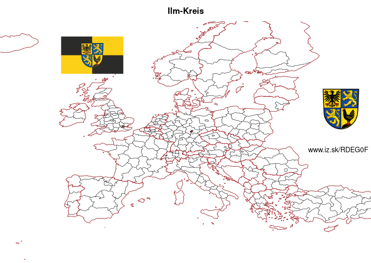
Ilm-Kreis – DEG0F
EU regions: Germany > Thuringia > Thuringia > Ilm-Kreis

| Indicator | Period | Value |
|---|
Ilm-Kreis slovensky: DEG0F
Demographics
| Indicator | Period | Value |
|---|---|---|
| Demographics | ||
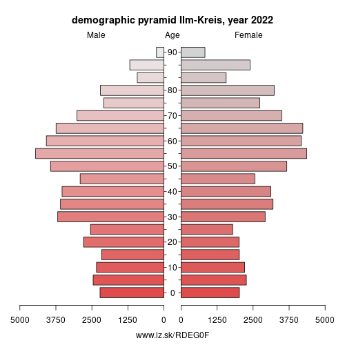
| number of inhabitants | 2023 | 106 776 |
| population density | 2022 | 125.8 |
| old-age dependency ratio | 2023 | 44.1 |

From Wikipedia : Ilm-Kreis is a district in Thuringia, Germany. It is bounded by (from the north and clockwise) the city of Erfurt, the districts of Weimarer Land, Saalfeld-Rudolstadt and Hildburghausen, the city of Suhl, and the districts of Schmalkalden-Meiningen and Gotha. It is named after the river Ilm, flowing through the district.
History
In medieval times the territory was ruled by the counts of Henneberg and the princes of Schwarzburg, two local dynasties. While Ilmenau was ruled by Henneberg, Arnstadt belonged to Schwarzburg. When the Henneberg family became extinct in 1583, Ilmenau was acquired by Saxony. In the meantime the principality of Schwarzburg began to disintegrate and was split up in several tiny states. One of those states (Schwarzburg-Arnstadt) was based in Arnstadt; it was founded in 1574 and existed until 1716, when it fell to Schwarzburg-Sondershausen. This mini state existed until 1920, when the state of Thuringia was founded.
The district was founded in 1920 (under the name Arnstadt); it was divided in 1952 into the districts of Arnstadt and Ilmenau, but reunited in 1994.
Other: Thuringia, Saale-Holzland-Kreis, Saale-Orla-Kreis, Greiz, Altenburger Land, Eisenach, Erfurt, Wartburgkreis, Gera, Weimar, Eichsfeld, Kyffhäuserkreis, Schmalkalden-Meiningen, Sömmerda, Ilm-Kreis, Suhl, Sonneberg, Unstrut-Hainich-Kreis, Jena, Hildburghausen, Weimarer Land, Nordhausen, Landkreis Saalfeld-Rudolstadt, Gotha
Neighbours: Landkreis Saalfeld-Rudolstadt, Hildburghausen, Erfurt, Suhl, Weimarer Land, Gotha, Schmalkalden-Meiningen
Suggested citation: Michal Páleník: Europe and its regions in numbers - Ilm-Kreis – DEG0F, IZ Bratislava, retrieved from: https://www.iz.sk/PDEG0F, ISBN: 978-80-970204-9-1, DOI:10.5281/zenodo.10200164

 Share
Share Facebook
 Twitter
 News
News