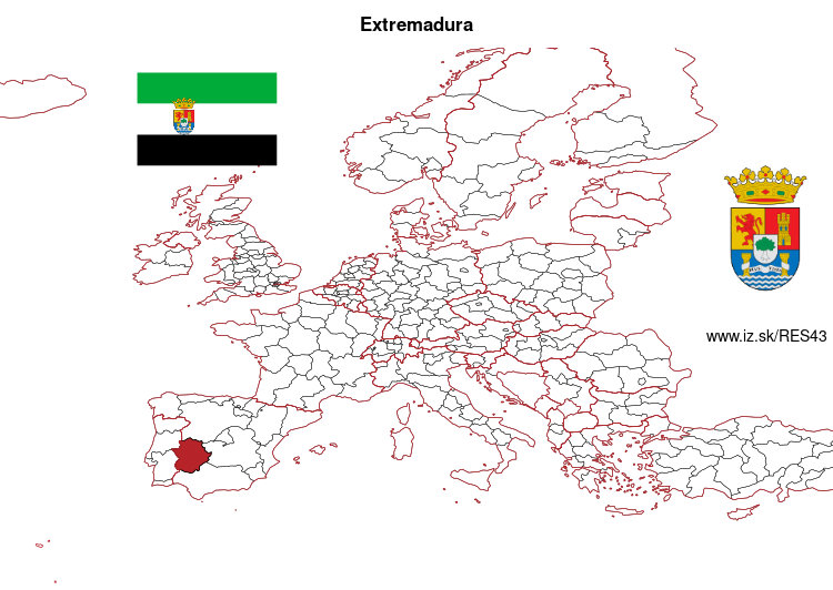
Extremadura – ES43
EU regions: Spain > Centro > Extremadura
| Indicator | Period | Value |
|---|---|---|
| Life long learning | ||
| life long learning participation | 2025 | 14.8 |
| Part time jobs and flexible employment | ||
| percentage of part time workers | 2025 | 12.55 |
| percentage of part time workers, men | 2025 | 4.09 |
| percentage of part time workers, women | 2025 | 22.71 |
| Gender differences | ||
| gender gap in employment rate | 2025 | 82.99 |
| gender gap in unemployment rate | 2025 | 143.09 |
| Graduates and young people | ||
| unemployment rate of youth with elementary education | 2025 | 45.9 |
| NEET | 2025 | 10.1 |
| Gross domestic product | ||
| GDP per capita in PPS of EU average | 2024 | 70 |
| Employment | ||
| employment rate | 2025 | 61.9 |
| Social exclusion | ||
| people at risk of poverty or social exclusion | 2020 | 38.7 |
Extremadura slovensky: ES43
Subregions: Province of Badajoz, Cáceres Province
Unemployment
| Indicator | Period | Value |
|---|---|---|
| Unemployment | ||
| unemployment rate | 2025 | 14.9 |
| youth unemployment rate | 2025 | 37.4 |
| Long term unemployment | ||
| long term unemployment | 2025 | 4.6 |
| share of long term unemployed | 2025 | 31 |
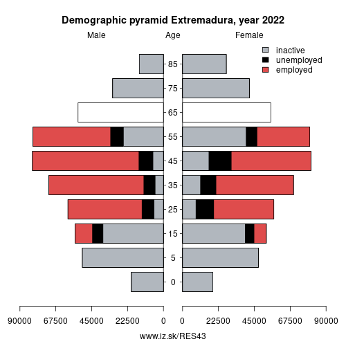
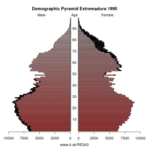
Demographics
| Indicator | Period | Value |
|---|---|---|
| Demographics | ||
| number of inhabitants | 2025 | 1 053 345 |
| population density | 2024 | 25.8 |
| old-age dependency ratio | 2025 | 35.4 |
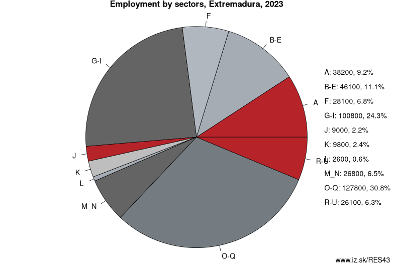
Employment by sectors, Extremadura
| NACE r2 | % | NACE r2 | % | ||
|---|---|---|---|---|---|
| A | 39.9 | 9% | B-E | 41.9 | 10% |
| F | 30.5 | 7% | G-I | 101.4 | 24% |
| J | 8.8 | 2% | K | 7.7 | 2% |
| L | 1.6 | 0% | M_N | 32.5 | 8% |
| O-Q | 139.6 | 33% | R-U | 24.6 | 6% |
| TOTAL | 428.4 | 100% |
Data for the period year 2025. Source of the data is Eurostat, table [lfst_r_lfe2en2].
From Wikipedia : Extremadura (; Spanish: [e(ɣ)stɾemaˈðuɾa]) is an autonomous community of the western Iberian Peninsula whose capital city is Mérida, recognised by the Statute of Autonomy of Extremadura. It is made up of the two largest provinces of Spain: Cáceres and Badajoz. It is bordered by the provinces of Salamanca and Ávila (Castile and León) to the north; by provinces of Toledo and Ciudad Real (Castile–La Mancha) to the east, and by the provinces of Huelva, Seville, and Córdoba (Andalusia) to the south; and by Portugal to the west. Its official language is Spanish.
It is an important area for wildlife, particularly with the major reserve at Monfragüe, which was designated a National Park in 2007, and the International Tagus River Natural Park (Parque Natural Tajo Internacional). The government of Extremadura is called Gobierno de Extremadura.
The Day of Extremadura is celebrated on 8 September. It coincides with the Catholic festivity of Our Lady of Guadalupe.
Geography
Extremadura is contained between 37° 57′ and 40° 85′ N latitude, and 4° 39′ and 7° 33′ W longitude.
The area of Extremadura is 41,633 km2 (16,075 sq mi), making it the fifth largest of the Spanish autonomous communities.
Other: Centro, Extremadura, Castilla–La Mancha, Castile and León
Neighbours: Castilla–La Mancha, Andalusia, Centro region, Castile and León, Alentejo region
Subregions: Province of Badajoz, Cáceres Province
Suggested citation: Michal Páleník: Europe and its regions in numbers - Extremadura – ES43, IZ Bratislava, retrieved from: https://www.iz.sk/PES43, ISBN: 978-80-970204-9-1, DOI:10.5281/zenodo.10200164
Similar articles
Navigation:
- Short news
- Local Administrative Units data of Visegrad countries open data
- Projects and activities
- European regions
- Random region: Austria, East Austria, Wien
 Share
Share Facebook
 Twitter
 News
News