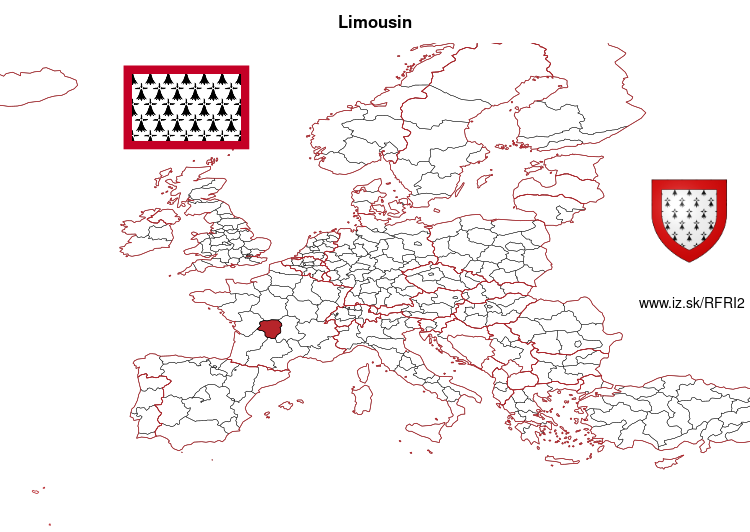
Limousin – FRI2
EU regions: France > Nouvelle-Aquitaine > Limousin
| Indicator | Period | Value |
|---|---|---|
| Life long learning | ||
| life long learning participation | 2025 | 16.2 |
| Part time jobs and flexible employment | ||
| percentage of part time workers | 2025 | 18.66 |
| percentage of part time workers, men | 2025 | 13.43 |
| percentage of part time workers, women | 2025 | 24.33 |
| Gender differences | ||
| gender gap in employment rate | 2025 | 98.61 |
| gender gap in unemployment rate | 2025 | 98.39 |
| Graduates and young people | ||
| unemployment rate of youth with elementary education | 2017 | 31.5 |
| NEET | 2024 | 11.5 |
| Gross domestic product | ||
| GDP per capita in PPS of EU average | 2024 | 74 |
| Employment | ||
| employment rate | 2025 | 71.5 |
Limousin slovensky: FRI2
Subregions: Corrèze, Creuse, Haute-Vienne
Unemployment
| Indicator | Period | Value |
|---|---|---|
| Unemployment | ||
| unemployment rate | 2025 | 6.3 |
| youth unemployment rate | 2023 | 15 |
| Long term unemployment | ||
| long term unemployment | 2021 | 1.7 |
| share of long term unemployed | 2021 | 27.8 |
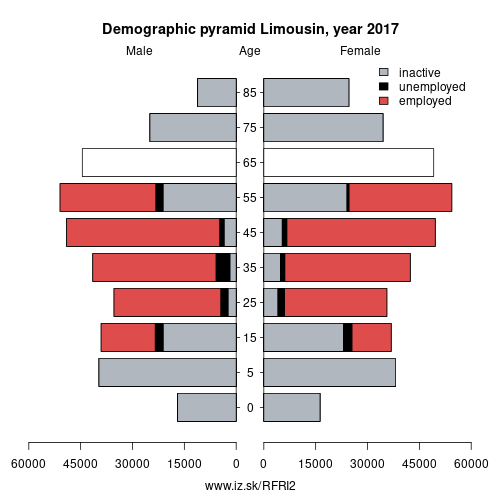
Demographics
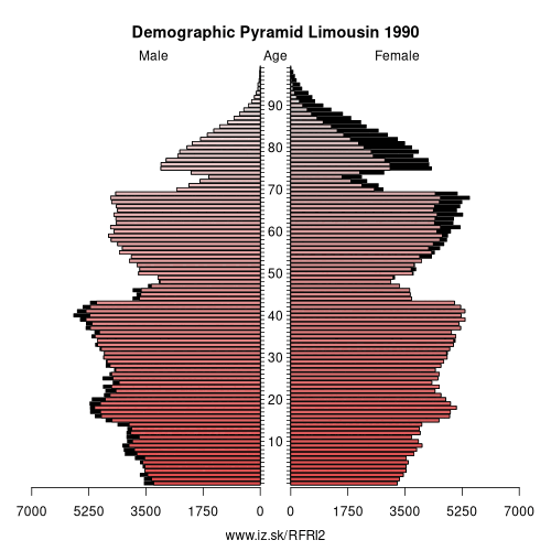
| Indicator | Period | Value |
|---|---|---|
| Demographics | ||
| number of inhabitants | 2025 | 729 224 |
| population density | 2024 | 43 |
| old-age dependency ratio | 2025 | 49.5 |
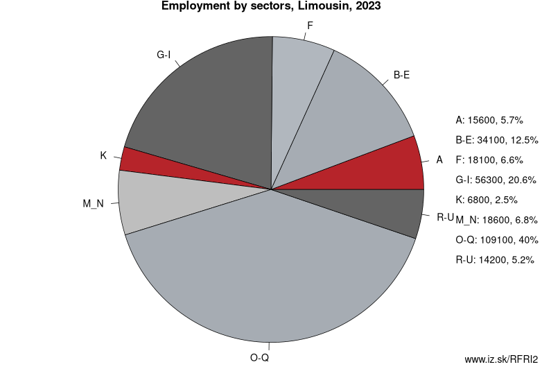
Employment by sectors, Limousin
| NACE r2 | % | NACE r2 | % | ||
|---|---|---|---|---|---|
| A | 11.3 | 4% | B-E | 42.2 | 14% |
| F | 23.3 | 8% | G-I | 58.7 | 20% |
| J | 5.4 | 2% | K | 9.7 | 3% |
| M_N | 22.2 | 8% | O-Q | 99.1 | 34% |
| R-U | 17 | 6% | TOTAL | 294.3 | 100% |
Data for the period year 2025. Source of the data is Eurostat, table [lfst_r_lfe2en2].
From Wikipedia : Limousin (French: [limuzɛ̃] (listen); Occitan: Lemosin [lemuˈzi]) is a former administrative region of southwest-central France. On 1 January 2016, it became part of the new administrative region of Nouvelle-Aquitaine. It comprised three departments: Corrèze, Creuse, and Haute-Vienne.
Situated mostly in the west side of south-central French Massif Central, Limousin had (in 2010) 742,770 inhabitants spread out on nearly 17,000 km2 (6,600 square miles), making it the least populated region of metropolitan France.
Forming part of the southwest of the country, Limousin is bordered by the regions of Centre-Val de Loire to the north, Auvergne to the east, Midi-Pyrénées to the south, Aquitaine to the southwest, and Poitou-Charentes to the west. Limousin is also part of the larger historical Occitania region.
Formation
The modern region of Limousin is essentially composed of two historical French provinces:
- Limousin: the department of Corrèze in its entirety and the central and southeastern part of Haute-Vienne. The entire old province of Limousin is contained within the modern Limousin.
- Marche: most of the department of Creuse and the north of Haute-Vienne. The old province of Marche is almost entirely contained within the modern region of Limousin, with only a small part of Marche now belonging to the region of Centre.
- Angoumois: extreme south-west of Haute-Vienne
- Poitou: extreme west of Haute-Vienne
- Auvergne: extreme east of Creuse
- Berry: extreme north of Creuse
Other: Nouvelle-Aquitaine, Poitou-Charentes, Aquitaine, Limousin
Neighbours: Auvergne, Centre-Val de Loire, Midi-Pyrénées, Poitou-Charentes, Aquitaine
Subregions: Corrèze, Creuse, Haute-Vienne
Suggested citation: Michal Páleník: Europe and its regions in numbers - Limousin – FRI2, IZ Bratislava, retrieved from: https://www.iz.sk/PFRI2, ISBN: 978-80-970204-9-1, DOI:10.5281/zenodo.10200164
 Share
Share Facebook
 Twitter
 News
News